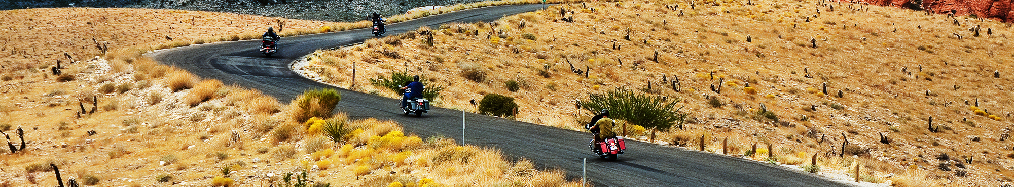
Motorcycle Roads in Missouri
Missouri (MO) is full of great motorcycle roads as the state is blessed with rolling/hilly topography & vast stretches of unspoiled scenery resulting in a smorgasbord of winding & rambling country roads for motorcycle riders to choose from. Some of the Midwest's best motorcycle rides are found in The Show Me State when you combine this great scenery with a state that has a healthy supply of tourist pleasing attractions. Attractions such as wineries, camping/hiking, quaint villages featuring antiques and artisan crafts, and world class accommodations in locations such as Branson, Kansas City, and St. Louis. The best motorcycle roads & rides in Missouri are generally located southwest of St. Louis (south of I-70 and west of I-55). They tend to travel through the 1.5 million acres of the Mark Twain National Forest as it is heavily wooded and quite hilly which not only means you'll be treated to endless curves but you'll also find that the area is very sparsely populated so motorcycle riders often have the roads to themselves. The other best motorcycle rides in Missouri are found further to the west near the beautiful areas surrounding Branson and Ozark, MO.
Best Rated Motorcycle Roads & Rides
Please be patient. Routes will begin to appear on map approximately 10 seconds after the map loads at a rate of one route per second.
Color Key: top-5 ranked routes in the state
#1#2#3#4#5
Routes ranked below the top-5 are drawn in gray
![Route 66 - 1936 St. Louis to Grey Summit City | United States Route 66 - 1936 St. Louis to Grey Summit City | United States](https://mcr-live.s3.us-west-1.amazonaws.com/route_map_original_images_drupal/map_image64038.png)
Scenery
Ride Enjoyment
Tourism Opportunities
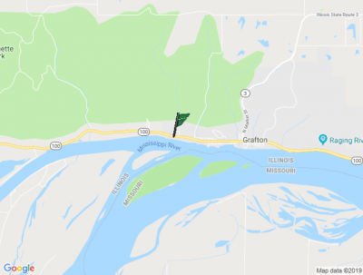
The route starts at the historic Chain of Rocks Bridge and follows the Mississippi River riverfront before turning onto Broadway. A brief passage through the historic Bellefontaine and Calvary…
![speedo-meter](https://www.motorcycleroads.com//themes/custom/motorcycleroads/images/speedo-meter.png)
![speedo-arrow](https://www.motorcycleroads.com//themes/custom/motorcycleroads/images/speedo-arrow.png)
![speedo-meter-grey](https://www.motorcycleroads.com//themes/custom/motorcycleroads/images/rate-meter-grey.png)
![MO 51/IL 3 - Back way from Poplar Bluff to St. Louis | United States MO 51/IL 3 - Back way from Poplar Bluff to St. Louis | United States](https://mcr-live.s3.us-west-1.amazonaws.com/route_map_original_images_drupal/map_big_image2377.png)
Scenery
Ride Enjoyment
Tourism Opportunities
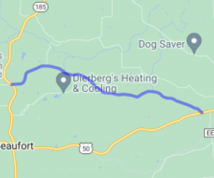
This is a much more scenic route than droning down 67 or Business 60 to 55. Super slabs (highways/interstate) get extremely boring and this is a nice route to mix it up a bit.
The first half of…
![speedo-meter](https://www.motorcycleroads.com//themes/custom/motorcycleroads/images/speedo-meter.png)
![speedo-arrow](https://www.motorcycleroads.com//themes/custom/motorcycleroads/images/speedo-arrow.png)
![speedo-meter-grey](https://www.motorcycleroads.com//themes/custom/motorcycleroads/images/rate-meter-grey.png)
![Road between Hwy 100 and Hwy T | United States Road between Hwy 100 and Hwy T | United States](https://mcr-live.s3.us-west-1.amazonaws.com/route_map_original_images_drupal/map_image62499.png)
Scenery
Ride Enjoyment
Tourism Opportunities
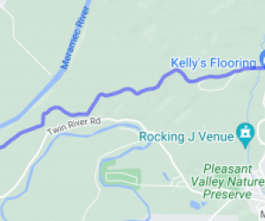
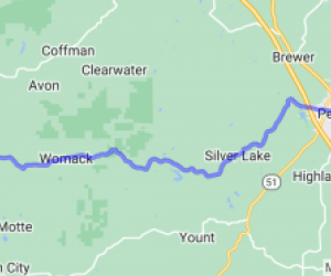
This route travels through heavy woods over and along several ridges and creeks, past several farms.
![speedo-meter](https://www.motorcycleroads.com//themes/custom/motorcycleroads/images/speedo-meter.png)
![speedo-arrow](https://www.motorcycleroads.com//themes/custom/motorcycleroads/images/speedo-arrow.png)
![speedo-meter-grey](https://www.motorcycleroads.com//themes/custom/motorcycleroads/images/rate-meter-grey.png)
![Hwy PP/Twin Rivers Road | United States Hwy PP/Twin Rivers Road | United States](https://mcr-live.s3.us-west-1.amazonaws.com/route_map_original_images_drupal/map_image64041.png)
Scenery
Ride Enjoyment
Tourism Opportunities
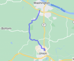
The route goes along Antire Creek until the end of Hwy PP, then along the Big River to the end, passing several farms and horse ranches while skirting heavily wooded bluffs on your right hand side.
![speedo-meter](https://www.motorcycleroads.com//themes/custom/motorcycleroads/images/speedo-meter.png)
![speedo-arrow](https://www.motorcycleroads.com//themes/custom/motorcycleroads/images/speedo-arrow.png)
![speedo-meter-grey](https://www.motorcycleroads.com//themes/custom/motorcycleroads/images/rate-meter-grey.png)
![Hunning Road/Old Sugar Creek Road | United States Hunning Road/Old Sugar Creek Road | United States](https://mcr-live.s3.us-west-1.amazonaws.com/route_map_original_images_drupal/map_image62513.png)
Scenery
Ride Enjoyment
Tourism Opportunities
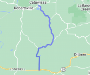
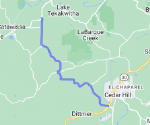
The route goes through deep woods just to the east of Hwy 30 and right next to Sugar Creek for a few miles.
![speedo-meter](https://www.motorcycleroads.com//themes/custom/motorcycleroads/images/speedo-meter.png)
![speedo-arrow](https://www.motorcycleroads.com//themes/custom/motorcycleroads/images/speedo-arrow.png)
![speedo-meter-grey](https://www.motorcycleroads.com//themes/custom/motorcycleroads/images/rate-meter-grey.png)
![HWY 42 between Vienna and Belle | United States HWY 42 between Vienna and Belle | United States](https://mcr-live.s3.us-west-1.amazonaws.com/route_map_original_images_drupal/map_big_image349.png)
Scenery
Ride Enjoyment
Tourism Opportunities
Everything from open fields to deciduous woods - neat Streams, farms, a small one-lane bridge...
![speedo-meter](https://www.motorcycleroads.com//themes/custom/motorcycleroads/images/speedo-meter.png)
![speedo-arrow](https://www.motorcycleroads.com//themes/custom/motorcycleroads/images/speedo-arrow.png)
![speedo-meter-grey](https://www.motorcycleroads.com//themes/custom/motorcycleroads/images/rate-meter-grey.png)
![Highway W - Jefferson County | United States Highway W - Jefferson County | United States](https://mcr-live.s3.us-west-1.amazonaws.com/route_map_original_images_drupal/map_image65413.png)
Scenery
Ride Enjoyment
Tourism Opportunities
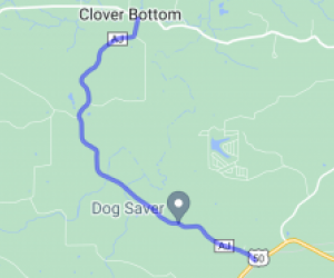
The route goes through the wooded hills and bluffs of the Big River in Jefferson County, and past a few farms and residential subdivisions.
![speedo-meter](https://www.motorcycleroads.com//themes/custom/motorcycleroads/images/speedo-meter.png)
![speedo-arrow](https://www.motorcycleroads.com//themes/custom/motorcycleroads/images/speedo-arrow.png)
![speedo-meter-grey](https://www.motorcycleroads.com//themes/custom/motorcycleroads/images/rate-meter-grey.png)
![Four Ridges Road | United States Four Ridges Road | United States](https://mcr-live.s3.us-west-1.amazonaws.com/route_map_original_images_drupal/map_image62534.png)
Scenery
Ride Enjoyment
Tourism Opportunities
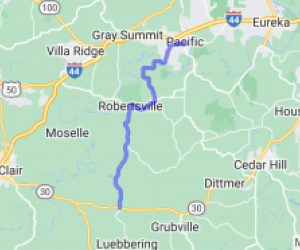
The route travels through wooded hills and valleys in central Jefferson County, past residential homes and a few farms.
![speedo-meter](https://www.motorcycleroads.com//themes/custom/motorcycleroads/images/speedo-meter.png)
![speedo-arrow](https://www.motorcycleroads.com//themes/custom/motorcycleroads/images/speedo-arrow.png)
![speedo-meter-grey](https://www.motorcycleroads.com//themes/custom/motorcycleroads/images/rate-meter-grey.png)
![Wildhorse Creek Road - St. Louis County | United States Wildhorse Creek Road - St. Louis County | United States](https://mcr-live.s3.us-west-1.amazonaws.com/route_map_original_images_drupal/map_image63010.png)
Scenery
Ride Enjoyment
Tourism Opportunities
The beginning of the route is in suburban St. Louis County, and is a mix of hills, residential subdivisions, and some strip malls. Once past Hwy 109, the scenery changes to heavy woods, as the route…
![speedo-meter](https://www.motorcycleroads.com//themes/custom/motorcycleroads/images/speedo-meter.png)
![speedo-arrow](https://www.motorcycleroads.com//themes/custom/motorcycleroads/images/speedo-arrow.png)
![speedo-meter-grey](https://www.motorcycleroads.com//themes/custom/motorcycleroads/images/rate-meter-grey.png)
![testtttt test](https://mcr-live.s3.us-west-1.amazonaws.com/default_images/download%20%281%29.jpg)
Scenery
Ride Enjoyment
Tourism Opportunities
This is an urban/suburban ride, and includes everything from wooded stretches to skyscrapers.
![speedo-meter](https://www.motorcycleroads.com//themes/custom/motorcycleroads/images/speedo-meter.png)
![speedo-arrow](https://www.motorcycleroads.com//themes/custom/motorcycleroads/images/speedo-arrow.png)
![speedo-meter-grey](https://www.motorcycleroads.com//themes/custom/motorcycleroads/images/rate-meter-grey.png)
![Mark Twain National Forest Circle | United States Mark Twain National Forest Circle | United States](https://mcr-live.s3.us-west-1.amazonaws.com/route_map_original_images_drupal/map_big_image1912.png)
Scenery
Ride Enjoyment
Tourism Opportunities
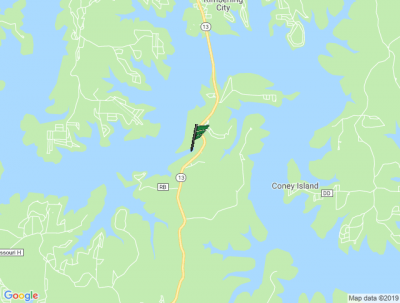
This route takes you in an around the Mark Twain National forest. Many great overlooks and lots of creek and river crossings.
![speedo-meter](https://www.motorcycleroads.com//themes/custom/motorcycleroads/images/speedo-meter.png)
![speedo-arrow](https://www.motorcycleroads.com//themes/custom/motorcycleroads/images/speedo-arrow.png)
![speedo-meter-grey](https://www.motorcycleroads.com//themes/custom/motorcycleroads/images/rate-meter-grey.png)
![Double Dubya in Saint Genevieve County | United States Double Dubya in Saint Genevieve County | United States](https://mcr-live.s3.us-west-1.amazonaws.com/route_map_original_images_drupal/map_image61666.png)
Scenery
Ride Enjoyment
Tourism Opportunities
Route is mostly wooded, with a little over half of the route within the eastern portion of the Mark Twain National Forest.
![speedo-meter](https://www.motorcycleroads.com//themes/custom/motorcycleroads/images/speedo-meter.png)
![speedo-arrow](https://www.motorcycleroads.com//themes/custom/motorcycleroads/images/speedo-arrow.png)
![speedo-meter-grey](https://www.motorcycleroads.com//themes/custom/motorcycleroads/images/rate-meter-grey.png)
![Route 66 - 1926 St. Louis to Grey Summit | United States Route 66 - 1926 St. Louis to Grey Summit | United States](https://mcr-live.s3.us-west-1.amazonaws.com/route_map_original_images_drupal/map_image63613.png)
Scenery
Ride Enjoyment
Tourism Opportunities
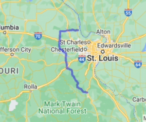
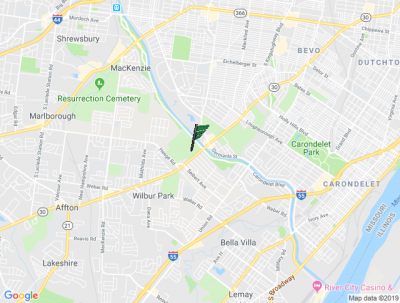
The route starts at the Mississippi River, and proceeds initially through the urban streets of North St. Louis City, then through Midtown, the Central West End, and across the north and west sides of…
![speedo-meter](https://www.motorcycleroads.com//themes/custom/motorcycleroads/images/speedo-meter.png)
![speedo-arrow](https://www.motorcycleroads.com//themes/custom/motorcycleroads/images/speedo-arrow.png)
![speedo-meter-grey](https://www.motorcycleroads.com//themes/custom/motorcycleroads/images/rate-meter-grey.png)
![Roaring River Roller Coaster | United States Roaring River Roller Coaster | United States](https://mcr-live.s3.us-west-1.amazonaws.com/route_map_original_images_drupal/map_big_image1990.png)
Scenery
Ride Enjoyment
Tourism Opportunities
Some small farms, but mostly wooded and some scenic views. Sometimes can see bald eagles...
![speedo-meter](https://www.motorcycleroads.com//themes/custom/motorcycleroads/images/speedo-meter.png)
![speedo-arrow](https://www.motorcycleroads.com//themes/custom/motorcycleroads/images/speedo-arrow.png)
![speedo-meter-grey](https://www.motorcycleroads.com//themes/custom/motorcycleroads/images/rate-meter-grey.png)
![US Route 66 - Grey Summit to Rolla | United States US Route 66 - Grey Summit to Rolla | United States](https://mcr-live.s3.us-west-1.amazonaws.com/route_map_original_images_drupal/map_image64785.png)
Scenery
Ride Enjoyment
Tourism Opportunities
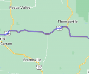
The views along this route are mixed. Much of the route is essentially the service road for I-44, so the view isn't very interesting, at least on the highway side. However, since the road is often…
![speedo-meter](https://www.motorcycleroads.com//themes/custom/motorcycleroads/images/speedo-meter.png)
![speedo-arrow](https://www.motorcycleroads.com//themes/custom/motorcycleroads/images/speedo-arrow.png)
![speedo-meter-grey](https://www.motorcycleroads.com//themes/custom/motorcycleroads/images/rate-meter-grey.png)
![Hwy N - Osage County | United States Hwy N - Osage County | United States](https://mcr-live.s3.us-west-1.amazonaws.com/route_map_original_images_drupal/map_image61991.png)
Scenery
Ride Enjoyment
Tourism Opportunities
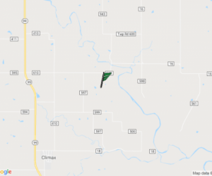
This route goes through mid-Missouri, in the rolling hills of Osage County. The route is entirely rural, and offers great opportunities for both spring flowers and fall foliage.
![speedo-meter](https://www.motorcycleroads.com//themes/custom/motorcycleroads/images/speedo-meter.png)
![speedo-arrow](https://www.motorcycleroads.com//themes/custom/motorcycleroads/images/speedo-arrow.png)
![speedo-meter-grey](https://www.motorcycleroads.com//themes/custom/motorcycleroads/images/rate-meter-grey.png)
![Route 66 - 1936 St. Louis to Grey Summit Bypass | United States Route 66 - 1936 St. Louis to Grey Summit Bypass | United States](https://mcr-live.s3.us-west-1.amazonaws.com/route_map_original_images_drupal/map_image63865.png)
Scenery
Ride Enjoyment
Tourism Opportunities
The beginning part of the route parallels I-270, and is typical of a "frontage road" for an interstate in an metro area. Lindbergh Blvd/Kirkwood Rd travels around (and under) the west end of Lambert…
![speedo-meter](https://www.motorcycleroads.com//themes/custom/motorcycleroads/images/speedo-meter.png)
![speedo-arrow](https://www.motorcycleroads.com//themes/custom/motorcycleroads/images/speedo-arrow.png)
![speedo-meter-grey](https://www.motorcycleroads.com//themes/custom/motorcycleroads/images/rate-meter-grey.png)
![Central Rural Triangle | United States Central Rural Triangle | United States](https://mcr-live.s3.us-west-1.amazonaws.com/route_map_original_images_drupal/map_big_image350.png)
Scenery
Ride Enjoyment
Tourism Opportunities
Scenery is typical Ozark Plateau. Rolling hills give way to stretches of farmland and sweeping river valleys. High elevations in the road allow great views of the surrounding terrain. Nearby Bennett…
![speedo-meter](https://www.motorcycleroads.com//themes/custom/motorcycleroads/images/speedo-meter.png)
![speedo-arrow](https://www.motorcycleroads.com//themes/custom/motorcycleroads/images/speedo-arrow.png)
![speedo-meter-grey](https://www.motorcycleroads.com//themes/custom/motorcycleroads/images/rate-meter-grey.png)
![Hwy KK - Webster County | United States Hwy KK - Webster County | United States](https://mcr-live.s3.us-west-1.amazonaws.com/route_map_original_images_drupal/map_image62001.png)
Scenery
Ride Enjoyment
Tourism Opportunities
Rolling Missouri countryside just east of Springfield, MO. A gentle ride through farms and woods.
![speedo-meter](https://www.motorcycleroads.com//themes/custom/motorcycleroads/images/speedo-meter.png)
![speedo-arrow](https://www.motorcycleroads.com//themes/custom/motorcycleroads/images/speedo-arrow.png)
![speedo-meter-grey](https://www.motorcycleroads.com//themes/custom/motorcycleroads/images/rate-meter-grey.png)
![Saline to Konnert to Lonedell to Pomme Roads | United States Saline to Konnert to Lonedell to Pomme Roads | United States](https://mcr-live.s3.us-west-1.amazonaws.com/route_map_original_images_drupal/map_image62027.png)
Scenery
Ride Enjoyment
Tourism Opportunities
The route is heavily wooded, traveling past creeks, farms, and cul-de-sac subdivisions. The start of the route is at one end of the Gravois Bluffs shopping center, but quickly leaves the commercial…
![speedo-meter](https://www.motorcycleroads.com//themes/custom/motorcycleroads/images/speedo-meter.png)
![speedo-arrow](https://www.motorcycleroads.com//themes/custom/motorcycleroads/images/speedo-arrow.png)
![speedo-meter-grey](https://www.motorcycleroads.com//themes/custom/motorcycleroads/images/rate-meter-grey.png)