Written Directions
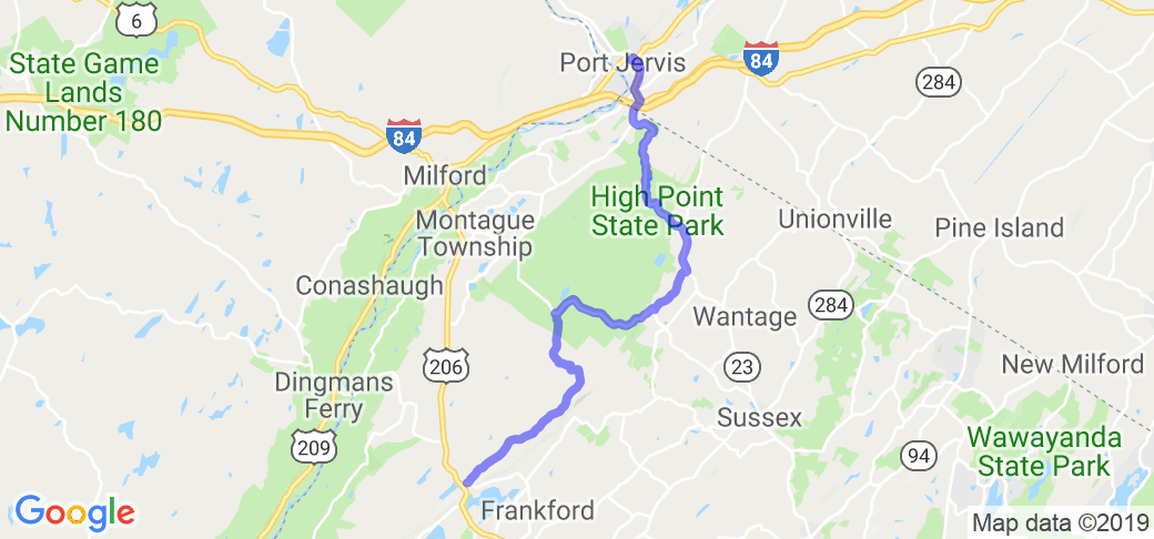
Start at the intersection of US 201 and NJ-636 (Upper North Shore Road). Head northeast on 636 and then take a left onto Sunrise Mt. Road to travel north through Stokes State Forest. (Sunrise Mountain Road is hard to find and difficult to identify on most maps.) Continue on Sunrise Mt. Rd. and turn right onto NJ-650 (Deckertown TPK). Turn left onto Brink Rd. and turn left (west) at NJ-23 to High Point State Park in route to Port Jervis, NY. (The optional Sunrise Mountain Scenic Overlook and High Point Monument turn-offs mentioned below increase the 20-mile ride another 5-miles.)
Scenery
Sunrise Mountain Road runs north along Kittatinny Ridge through New Jersey's unique and beautiful Stokes State Forest. There are no houses and the only indications of man's presence along the Robin Hood, Sherwood-like forest road are "One Way" signs. About midway along the road's 8-mile length, there is a good right-hand shoulder stop with a 180-degree view looking west at Pennsylvania's Pocono Mountains on the horizon. To the north, the High Point Monument can be seen on a clear day.
Another mile or so up the road is an optional right turn-off for the Sunrise Mountain Scenic Overlook parking area and a primitive relief facility. At the parking area, walk 300 yards south on the Appalachian Trail to the summit for a 270-degree panoramic view. During the fall, hawks and eagles may be seen migrating south as they soar high on thermals above colorful autumn foliage. Occasional hikers--some from as far away as Georgia, are sometimes walking the Appalachian Trail along the ridge.
An optional right turn-off on NJ-23 is to the High Point Monument (obelisk), built in 1930 to honor veterans. The base at 1,803 feet, is the highest elevation above sea level in the state of NJ. Within the monument, stairs lead to the top for a scenic view overlooking three states.
Drive Enjoyment
Single lane, one-way Sunrise Mt. Rd. is mostly straight and level except for the twisty, narrow two-way ascent to the Sunrise Mountain Scenic Overlook. NJ-23 is twisty on both the climb to High Point State Park and the descent to Port Jervis. All the roads are paved and in good condition.
Tourism Opportunities
There are no amenities in Stokes State Forest. High Point State Park offers seasonal swimming and camping. At Port Jervis, fuel and fast food are available.
Motorcycle Road Additional info
To complete a loop, consider taking River Rd. (NJ-521) in Port Jervis, to Old Mine Rd., NJ-560, NJ-521 and NJ-206 to return to the NJ-636 starting point.


 Write a review


 | United States")


- Ranch Roads 335, 336,337a | United States")


 | United States")


 | United States")


