Written Directions
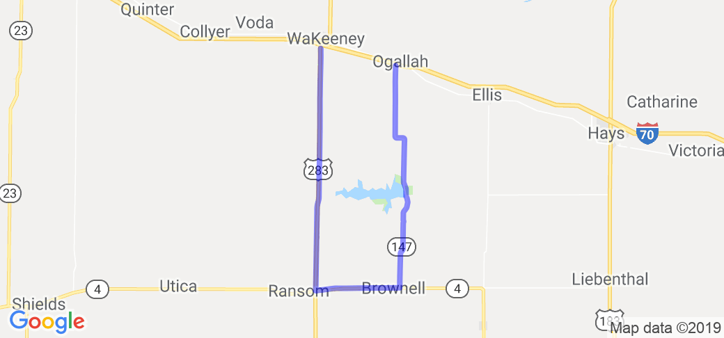
Starting in Ogallah you had south on Route 147 (Smokey Valley Scenic Byway) to Brownell then take a right (west) on Route 4 to Ransom and then turn right (north) on Hwy 283 up to WaKeeney where the route ends. Note: at that point you can go east back to Ogallah on a side road or on I-70.
Scenery
Named for their hazy, blue appearance at sunrise and sunset, the Smoky Hills divide the more easterly mixed-grass prairie from the shortgrass prairie of the Western Great Plains. The Smoky Valley Scenic Byway travels through the Smoky Hill River Valley, a showplace of native grasses and wildflowers year-round. Purple and bright-yellow coneflowers species, red-and-yellow Indian blanket flower, sky-blue pitcher sage, and cream-flowered yucca mix with big and little bluestem and grama grasses. Croplands provide additional color washes of emerald-green winter wheat in early spring and russet, ripened milo in autumn. Rock outcroppings hint at the foundation underlying the landscape - chalky limestone left by ancient seas.
Crossing the Smoky Hill River Valley, the Smoky Hills Trail was established at the Civil War's end to carry goods and travelers, including bona fide gold diggers, from Fort Leavenworth to Denver. Although it provided the shortest route to Denver, the trail was considered dangerous, and travel often required the protection of troops stationed at nearby Fort Hays. Today, two limestone markers identify the trail's crossing along the Byway. Carvings and markings, some more than 200 years old, can still be seen where trail travelers carved their names on the walls of Threshing Machine Canyon (the site of an 1850s Native American attack on a wagon train bearing a threshing machine) nearCedar Bluff State Park. You can see the threshing machine that was reclaimed from the canyon at the Trego County Historical Society Museum, which also houses vintage clothing (including baseball uniforms), antique farm equipment and medical instruments.
Drive Enjoyment
This is one of Kansas scenic byways so it is a very well maintained. Mostly straights the hole way with a few curves thrown in.
Tourism Opportunities
Crossing the Smoky Hill River Valley, the Smoky Hills Trail was established at the Civil War's end to carry goods and travelers, including bona fide gold diggers, from Fort Leavenworth to Denver. Although it provided the shortest route to Denver, the trail was considered dangerous, and travel often required the protection of troops stationed at nearby Fort Hays. Today, two limestone markers identify the trail's crossing along the Byway. Carvings and markings, some more than 200 years old, can still be seen where trail travelers carved their names on the walls of Threshing Machine Canyon (the site of an 1850s Native American attack on a wagon train bearing a threshing machine) nearCedar Bluff State Park. You can see the threshing machine that was reclaimed from the canyon at the Trego County Historical Society Museum, which also houses vintage clothing (including baseball uniforms), antique farm equipment and medical instruments.


 Write a review


 | United States")


- Ranch Roads 335, 336,337a | United States")


 | United States")


 | United States")


