Written Directions
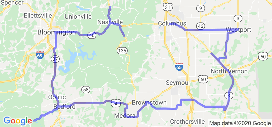
1. New Brownsville Covered Bridge -- Columbus -Mill Race Park on town's west side. It is on the main drive through the park: Carl Miske Drive, Columbus.
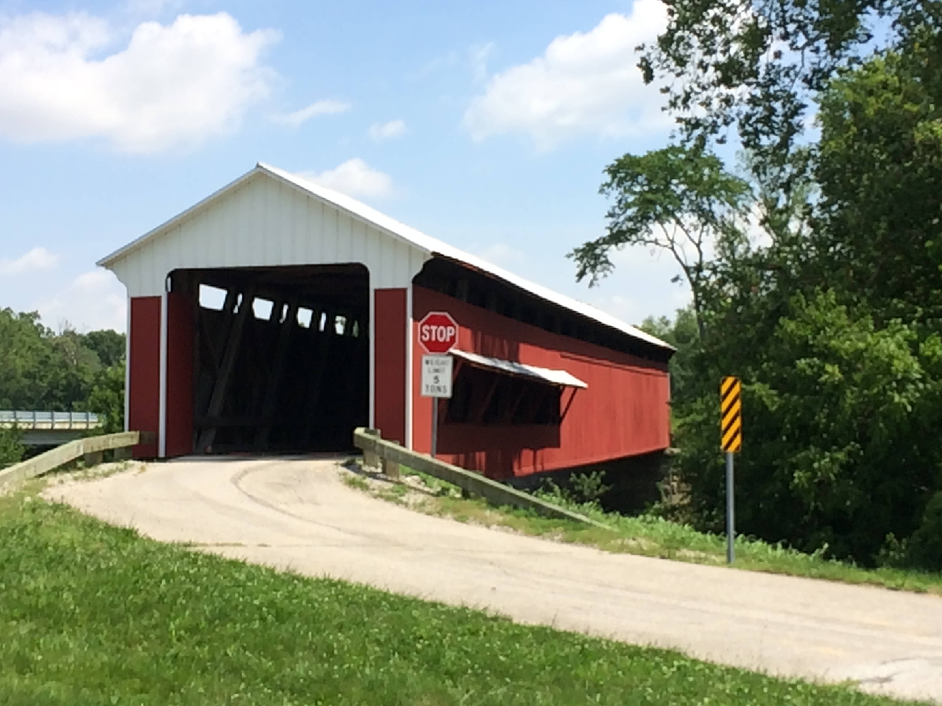
2. Westport Covered Bridge -- Take IN 46 east toward Greensburg, turning south on IN 3. Turn south on Main Street, about a mile out of town. It will be visible on your left. (If you find E 200 South coming out of Columbus go 5 miles and turn on 1100 South and go 7.2 miles): 3601 West Layton Drive, Westport.
3. Scipio Covered Bridge - We took County Road 1200 south of Westport in little town of Sardinia to cross over to IN 7. As approaching Scipio from the north, the bridge will be visible on your left, just behind the fire station: North County Road 575 W, Scipio.
4. James Covered Bridge - Continue south on IN 7 through North Vernon and Vernon. IN 3 peels off to the right outside of Vernon. Go 6.6 miles. Turn left on 625 South, which was not marked, but had a sign for a church at the highway. The bridge is ½ mile down the road: West County Road 625 South, Commiskey.
5. Shieldstown Covered Bridge - Take IN 3 south to Paris Crossing. Pick up IN 250 west to IN 39 to Brownstown. Taking US 50 north to 200 North, turn left (west). About a mile down the road it will be on the right. This is in poor repair. Signs did not even suggest even foot traffic. It appears to be on private land, but there are parking places there. 1917 East County Road 200 North, Seymour.
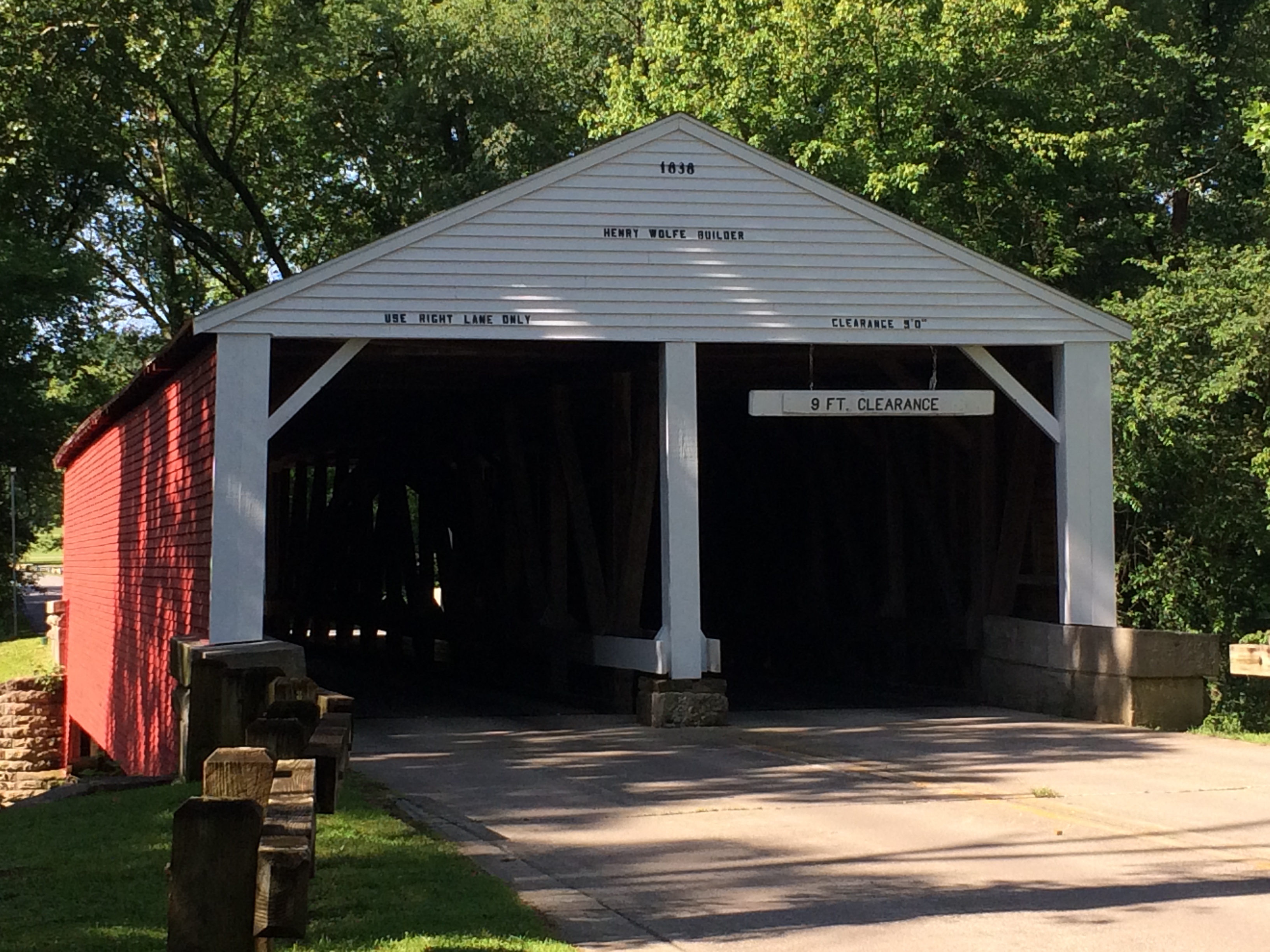
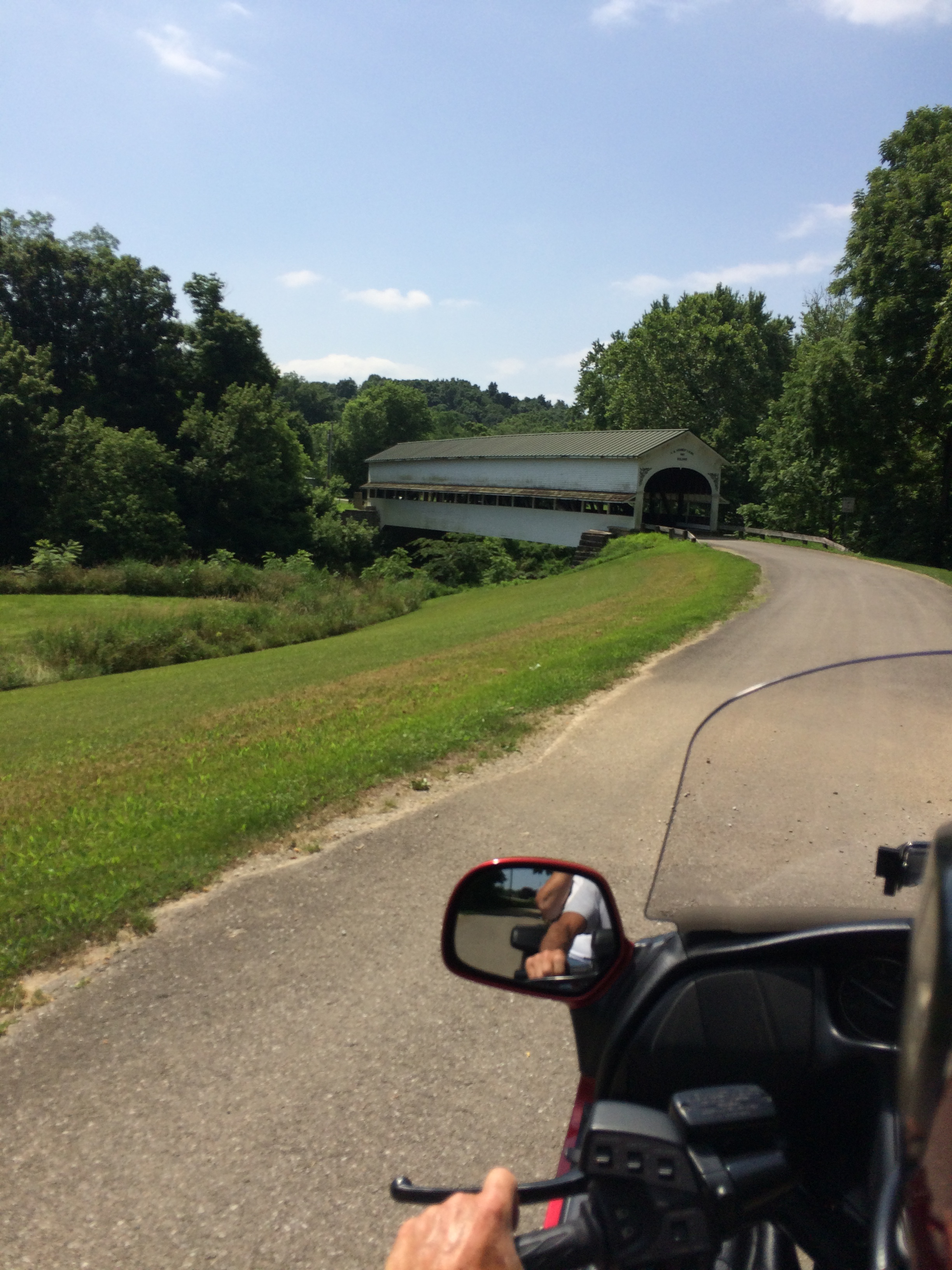
6. Medora Covered Bridge - Returning to Brownstown, go west through town on US 50 until IN 135 goes South. South of Vallonia, IN 235 goes to the right to Medora. Spring flooding had damaged road, but they were going to repair it, and it was open. The bridge will be on the right. This bridge is the only one on state maps. It is the longest historic covered bridge in US. East side has handicapped parking and west side had small park and picnic tables. A docent was on the bridge selling souvenirs and well worth the talking. Foot traffic only: IN 235. Vallonia.
7. Williams Covered Bridge - After traveling through Bedford on US 50, IN 450 goes south toward Williams. After 9.8 miles it will appear on the left. The approach from the north leads to barricades with some parking. The south approach is closed. Unfortunately, this seems to be where locals write their sexual slurs of each other. The graffiti was all over the floor; They have put fencing up the sides. Although it says video surveillance, we saw no camera. Foot traffic only: Williams is the only address.
8. Ramp Creek Covered Bridge - Return to Bedford on IN 450 and US 50. Turn north (left) on IN 37 to Bloomington. Heading east on IN 46 to Nashville and then south on IN 135/IN 46 1.7 miles, the bridge is at the north entrance of Brown County State Park. This dual-tunnel bridge - one of four in the country -- is before the gate, so you can visit it and not enter the park: 1801 State Road 46, Nashville.
9. Bean Blossom Covered Bridge - Turn north (left) on IN 135 at park entrance and go through Nashville. 4 miles north of town is Covered Bridge Road. It is gravel and the road was closed due to spring flooding. A local said we could also approach the bridge from the north by turning at the Dollar General in Bean Blossom onto IN 45. That approach was also closed. We did not see this bridge, but it is popular with local artists: 4619 Covered Bridge Road, Nashville.
Scenery
Southern Indiana hills and vales are showcased as you chase after covered bridges. Some is hill and curvy forested areas, others are straight through Indiana farmland.
Drive Enjoyment
Concern for unpaved county roads made us choose state highways that are well maintained. Only one road (the last) was not paved. Good quality throughout.
Tourism Opportunities
You pass through many small and moderate towns in southern Indiana. Gas and food is not a problem.
Motorcycle Road Additional info
These are rewritten turn-by-turn directions from the Only in your State website: www.onlyinyourstate.com/indiana/covered-bridge-loop-trail-in/The Google direction were confusing because it mentions no towns, and it assumes you know what county and township you are in.


 Write a review


 | United States")


- Ranch Roads 335, 336,337a | United States")


 | United States")


 | United States")


