Written Directions
The south end of this ride begins in Cookeville TN on North Willow Ave (aka Highway 135). The north end begins where Highway 53 intersects 135.
Scenery
Starting at the north end, after passing Roaring River Park, you'll enjoy the two-lane meandering beside the Roaring River on left, with tall hills in the background and in front. About a mile down the road, rock formations start from where the road was cut. These appear frequently until reaching Overton Cemetery 7.8 miles into the ride.
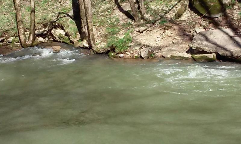
If you're interested in seeing fresh, cool, water boiling up in a pond turn left at the cemetery, over the bridge, and left at the T intersection. Travel one mile and you'll see a gravel drive on the left with guard rails on each side. Turn there. Park your bike in this packed dirt rec area and you'll see the spring from the right guard rail you just drove past to get in. It's not a geyser, but on a hot day this shaded pond is a terrific place to cool your feet. I asked a local who was in the water to capture the fresh water boiling in my empty Pepsi bottle. Being filtered in the rock strata, I took a sip. It tasted cool, pleasant and no side effects, similar to the spring water I enjoyed on Mt. Fuji. Here is my disclaimer: I would not recommend anyone else ingest water from this area.
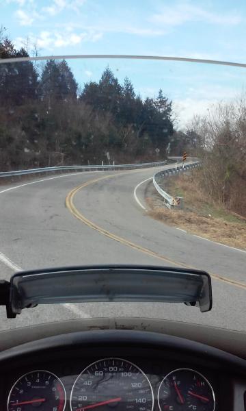
Returning to Dodson Branch Highway 135 and continuing south, the road quickly becomes a tight twisty heading up the small mountain. Rock cut-outs within ten feet of your right shoulder, valley scenery and drop-offs on the left. There's one switchback to the right you really need to pay extra attention to. Two 16' campers could not pass without rubbing. I like to have power ready to quickly straighten up my Voyager in such turns so with a fully-loaded machine this was first gear for me.
Traffic seemed to increase at the top as homes began to appear. From here to Cookeville scenery now includes fields, farms, and dwellings. The curves continue, but not all of them have signs to warn you. Enjoy them, but remember to give yourself enough space to see hazards and be able to stop.
About 14 miles into the ride is a convenience store.
Drive Enjoyment
This road has both gentle curves and tight twisties. One switchback. Some are blind curves, so take it easy. Paved road with a few asphalt patches.
Tourism Opportunities
The boiling spring is interesting. Places to wade and swim in the Roaring River and feeder creeks, but no public showers did I see. Dollar General at mile 14. Roaring River Recreation Area is near the north end of ride. Their information: (615)735-1034
Motorcycle Road Additional info
This makes for a great addition to the area rides already in Motorcycleroads.com.
Here is a video of the route:


 Write a review


 | United States")


- Ranch Roads 335, 336,337a | United States")


 | United States")


 | United States")


