Written Directions
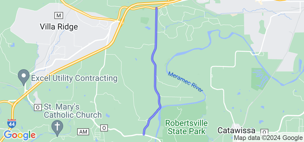
Make your way to the intersection of Hwy O and Robertsville Road (approximately 1.5 miles west of Robertsville, MO). Head north until you reach the intersection with MO-100 (Historic US Route 66).
Scenery
The route travels over several hills and through woods and farmlands typical of the Meramec River valley. The first half mile or so is within sight of the Meramec River, before leaving the river valley proper for the farmlands on the south side of Route 66.
Drive Enjoyment
The road starts off with several curves along the wooded riverside, then straightens out while retaining a rollercoaster feel typical of the Missouri countryside. The pavement is chip and seal, reasonable maintained, although some rough patches are possible.
Tourism Opportunities
While road's namesake Robertsville doesn't have any tourist attractions or amenities, the north end is just outside Gray Summit, which has some gas stations and other amenities. Just to the right on MO-100 is the Shaw Nature Reserve. Just beyond that is the junction of Manchester Road (MO-100, the original Route 66 alignment) and Watson Road (the "classic" Route 66 alignment).
Motorcycle Road Additional info
This is basically a "connector" road, between Hwy O and MO-100.


 Write a review


 | United States")


- Ranch Roads 335, 336,337a | United States")


 | United States")


