Written Directions
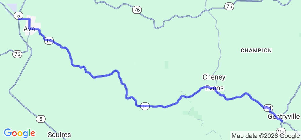
Starting at the intersection of MO-14 and MO-95 in Gentryville, MO, head west on MO-14 for approximately 22.3 miles to Ava, MO (MO-14 becomes E Washington St. as you enter Ava(. At the intersection with N. Jefferson St., turn right and continue for 0.6 miles to the traffic circle at Bacon Ave. Take the third exit from the traffic circle onto Bacon Ave., heading west. Continue for 0.7 miles to the intersection with MO-5/MO-76.
Scenery
The route is mostly wooded between the two towns of Gentryville and Ava, with occasional open fields and yards. As the route runs across ridgetops and through creek valleys, there are periodic panoramic views of the northern Missouri Ozarks. The heavy woods provide outstanding fall color scenery.
Drive Enjoyment
The route travels through the ridges and valleys of the Missouri Ozarks, with mostly easy curves with the occasional sequence of tighter curves (requiring close attention by the rider, as there is little warning of these tighter turns, which can often be masked by blind curves or hills crests). The rolling ridges mean near constant slight changes in elevation, in addition to the curves. The road is generally well maintained rolled asphalt.
Tourism Opportunities
Gentryville has a general store. The route passes by Rippee Conservation Area. The town of Ava is the county seat of Douglas County, and has a number of historic sites, including the Militia Springs Park and the Ava Ranger Station Historic District, a number of restaurants and shops, and is home to the Missouri Fox Trotting House Breed Association.


 Write a review


 | United States")


- Ranch Roads 335, 336,337a | United States")


 | United States")


