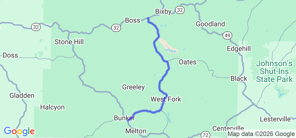
Written Directions
From Bixby, MO, travel approximately 2.5 miles west on MO-32 to the intersection with Hwy KK. Turn left (south) onto Hwy KK and continue for 15 miles, to the intersection with Hwy TT. Turn right to continue on Hwy KK for another 5 miles, to the intersection with MO-72 on the south edge of Bunker, MO.
Scenery
The route is tree lined over its entire length, although the tree line is well back from the road, giving a nice sweeping view of the road. There are a few valley crossings which give some broader scenic views, and a few sections that hug the hillsides.
Drive Enjoyment
The route is very open and sweeping for the first portion, with many easy 40-50 MPH curves and rolling hills. After turning west at the intersection with Hwy TT, there is a section of a series of tighter 30-35 MPH, before ending in some more sweeping 40-50 MPH turns before ending at MO-72 in Bunker. There are near continuous gentle elevation changes. The road is well maintained rolled asphalt. NOTE: Watch for large trucks near the mine entrances (see below).
Tourism Opportunities
The route is entirely within the Mark Twain National Forest, although there are no campsites or trailheads along the route. Bixby is home to the world renown Bixby General Store, famous for it's lunch sandwiches and ice cream (and, yes, it's a real general store, not a tourist attraction imitating one). Bunker has a couple of restaurants and shops.
The route passes by a few of the mining sites of the famous Doe Run Mining Company, including the Buick and Bushy Creek Mines.
Motorcycle Road Additional info
Route KK is often combined with MO-32, MO-49, and MO-72.


 Write a review


 | United States")


- Ranch Roads 335, 336,337a | United States")


 | United States")


 | United States")


