Written Directions
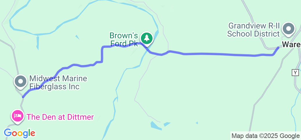
From De Soto, MO, take Hwy Y from MO-21 for approximately 7 miles, to the intersection with Brown's Ford Road (just past Grandview High School). Turn slightly left onto Brown's Ford Road (the beginning of the route), and follow the road for approximately 4.7 miles, to the intersection with Hwy WW (the end of the route). You can take Hwy WW north to MO-30 or south to Hwy H.
Scenery
The route is heavily wooded throughout the length of the route, with occasional breaks, and traveling alongside some bluffs at towards the last quarter of the route. The route passes over the Big River at about the halfway point.
Drive Enjoyment
The first half of the route is mostly straight with a few easy 30 MPH curves, but near constant elevation changes, giving it a bit of a rollercoaster feel. Once across the Big River, the road becomes a lot more curvy, with a few "esses" sections marked at 20-30 MPH, as well as a few tight, technical curves. There is a low water crossing across a feeder creek for the Big River (it's marked as "narrow bridge", but there is no actual bridge), and this crossing usually has some water in it, even when it hasn't rained recently - not deep, in general, but your tires will get wet.
Tourism Opportunities
The route goes past the Brown's Ford Park, which is the site of the former Brown's Ford (before the bridge on the road was built), which now has BBQ pits, picnic tables, ample parking and a primitive restroom, as well as a concrete boat ramp for access to the Big River, which is a designated Smallmouth Bass Trophy area.
Motorcycle Road Additional info
This route is a nice connector route between Hwy Y or C and Hwy WW.


 Write a review


 | United States")


- Ranch Roads 335, 336,337a | United States")


 | United States")


 | United States")


