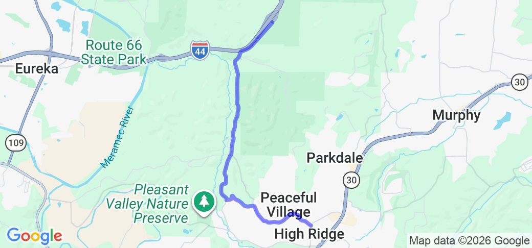
Written Directions
Take your best route to I-44 exit 269. On the south/west side of the interstate, turn right onto Antire Road. Continue for 2.8 miles to the intersection with JIm Weber Road and Little Antire Road. Turn left to continue on Antire Road. In 2.4 miles, the route ends at the intersection with High Ridge Boulevard.
Scenery
The route starts at the crest of Antire Ridge and descends down to the Antire Creek valley, and follows the base of the ridge until the intersection with Jim Weber and Little Antire Roads. It then turns and climbs up the side of the ridge until reaching High Ridge, MO. The route is almost completely through woods, with views of the creek valley along the way, and is especially notable when the trees are flowering in the spring and during the fall color period.
Drive Enjoyment
The route is very twisty and undulating, with several technical curves, including a switchback (with off-camber banking) at the 3.7 mile point. The pavement is mostly rolled asphalt with no shoulders and drop offs on the creek/down hill side of the road.
Tourism Opportunities
The route goes between Antire Valley County Park and the Beaumont Scout Reservation near the beginning of the route. The route ends in High Ridge, MO, with numerous restaurants, bars, and shops.
Motorcycle Road Additional info
This route is a favorite connector between MO-30 and I-44.


 Write a review


 | United States")


- Ranch Roads 335, 336,337a | United States")


 | United States")


