Written Directions
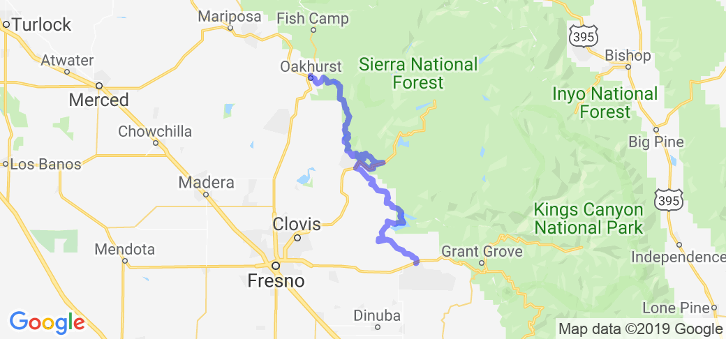
NOTE: the map above was developed by MotorcycleRoads.com only as a rough guide of the directions and should not be relied on soley as it can not be garanteed to be accurate. It comes very close to matching the road submitter's written directions below. The map above was developed using mapping software and may not be as accurate as the road submitter's version as often roads/signs on the ground are different than they are reflected "on the computer."
Subbmitter's Directions: "Beware, there are few road signs, it's easier to follow the signs to specific towns. On highway 180 between Squaw Valley, CA and Sequoia National Park (a couple miles east of Squaw Valley) follow the sign for Piedra (north on N. Elwood Rd). Near Piedra, follow the signs for Trimmer (Rt on N. Piedra Rd., Rt on E. Trimmer Springs Rd). Halfway around Pine Flat Reservoir, you'll hit Trimmer. Follow the signs to Tollhouse (Lt on Maxson Rd, Rt on Watts Valley Rd, becoming Burrough Valley Rd, Rt on Tollhouse Rd). Continue on Tollhouse Rd, following the signs to Pine Ridge. Around Pine ridge follow the signs to Auberry (Lt on Beal Fire Rd, cross hwy 168, Lt on Auberry Rd). Around Auberry follow the signs to North Fork (R on Powerhouse Rd, becoming 222). In North Fork, pass the Chevron, and turn left to stay on 222, and eventually turn right on 221, taking you to Bass Lake (the lake, not the town). Take the wooded ride clockwise (lake on the right) on 426, then South Shore Rd. At the large intersection, turn left, obeying the signs to highway 41 which takes you to Yosemite. It's 60 miles from Squaw Valley to North Fork. It's about another 60 or 70 from North Fork to the entrance of Yosemite. (In case you want to go on through, it's 185 miles from North Fork to Lee Vining, the Nevada side of Yosemite, and that includes a side tour inside Yosemite on Glacier Point Rd.) Notes: Set aside time and gas for when you get lost. Learn to use the sun to find your way. (What did you say? GPS?)
A side trip halfway through this route is highway 168, which takes you into Yosemite-like altitudes and around two more large lakes. This closed-loop highway is apparently for tourists and locals. The side route on highway 168 is a larger, more traveled road, and usually not as tight."
Scenery
This begins in rural farm and ranch country just outside of Sequoia National Park, and meanders into arid rolling hills and small mountains, becoming more scenic with every mile. Nice vistas include a sunny, cliff-side tour around Pine Lake Reservoir, and a cool, wooded tour around the edge of beautiful, blue-green Bass Lake. With unmarked roads, little traffic and apparently empty towns, you really feel like you're in a lost world. Numbed by this enchantment (and the lack of road signs) you can easily get lost and "have to" ride more scenic country or mountain roads. Towards the end of the ride it becomes more wooded, hilly, scenic and touristy, finally bringing you to the entrance of Yosemite National Park. This entire route averages 3 stars, but ranges from 2 to 4 stars. This begins in rural farm and ranch country just outside of Sequoia National Park, and meanders into arid rolling hills and small mountains, becoming more scenic with every mile. Nice vistas include a sunny, cliff-side tour around Pine Lake Reservoir, and a cool, wooded tour around the edge of beautiful, blue-green Bass Lake. With unmarked roads, little traffic and apparently empty towns, you really feel like you're in a lost world. Numbed by this enchantment (and the lack of road signs) you can easily get lost and "have to" ride more scenic country or mountain roads. Towards the end of the ride it becomes more wooded, hilly, scenic and touristy, finally bringing you to the entrance of Yosemite National Park. This entire route averages 3 stars, but ranges from 2 to 4 stars.
Drive Enjoyment
Starting this route is a nice warm up for what lay ahead. Occasional twists in low lying ranch land lead to curves in the foothills and small mountains, that are possibly dirty, and of typical pavement quality. Later the pavement becomes like 1 grit sandpaper, and for good reason. You are taking tight curves on a cliff-side, with nice vistas and no guard rails or shoulders. Keep your eyes on the road your first time through! This section of the trip deserves 5 stars, but some of the trip only 2 or 3 stars
Tourism Opportunities
This route basically connects Giant Sequoia National Park with Yosemite. The first 60 miles or so are quite rural, passing Pine Flat Reservoir, which is full of boats and might have a beach or two. At North Fork you can find civilization, gas and Bass Lake, a tourist trap that's not too busy in October. It becomes rural again as you proceed north to Yosemite National Park.
Motorcycle Road Additional info
- View the weather forecast for this area from Yahoo weather .


 | United States")


- Ranch Roads 335, 336,337a | United States")


 | United States")


 | United States")


