Motorcycle Route Author

By Guest (0 McR Points)
on Apr 01, 2003
Rider Reviews
Written Directions
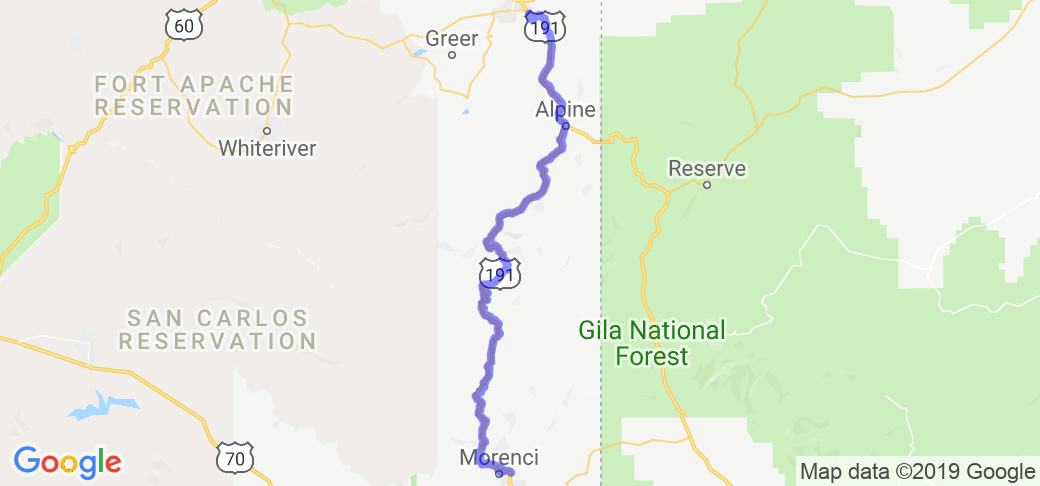
The way the road is described is by starting at Clifton, AZ and ending in Eagar, AZ. Of course you can reverse the direction if you like. Just look for Clifton and Eagar on the New Mexico/Arizona border which are about 200 miles east of Phoenix, AZ and take AZ Road 191.Scenery
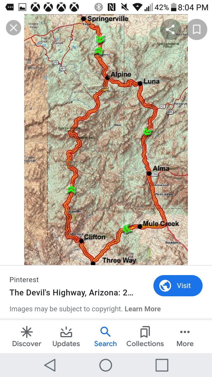
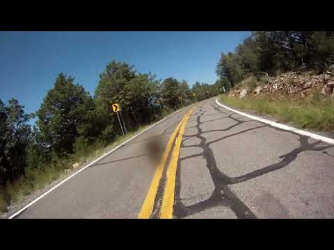
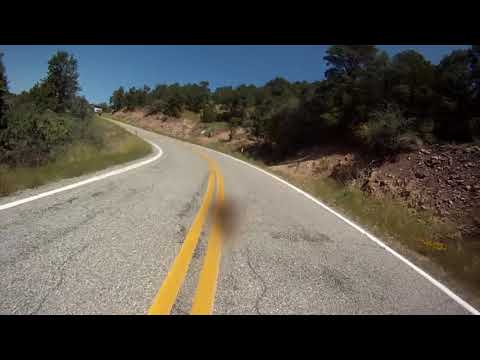
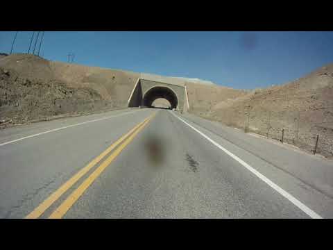
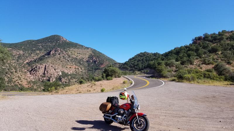
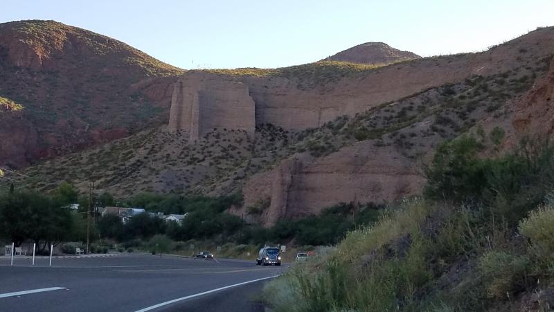
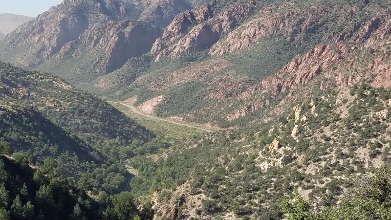
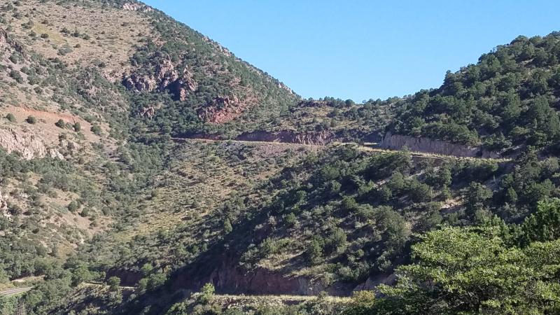
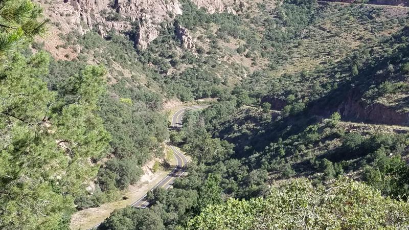
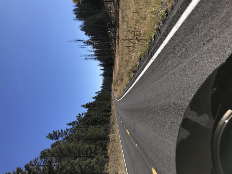
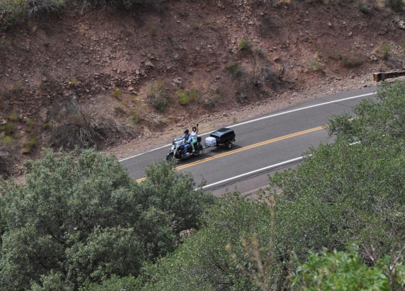
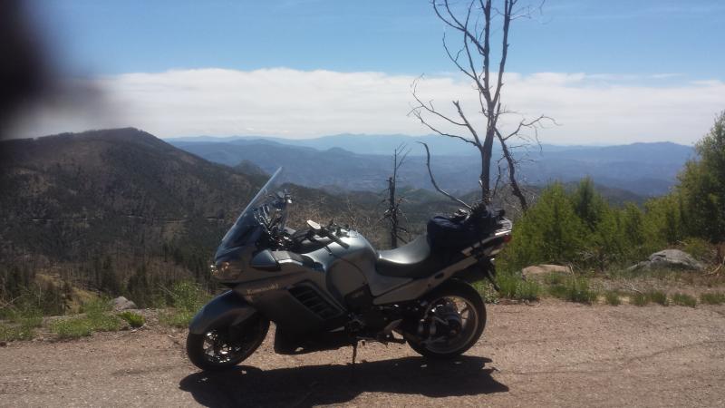
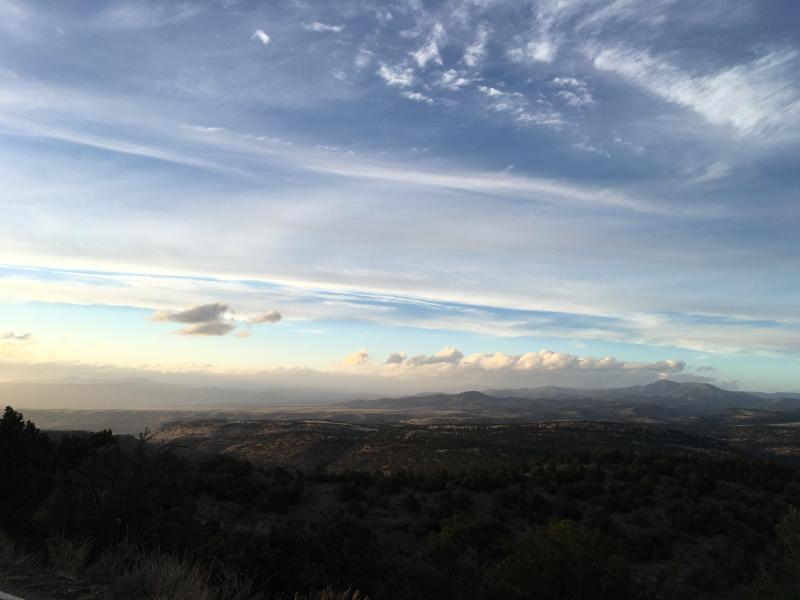
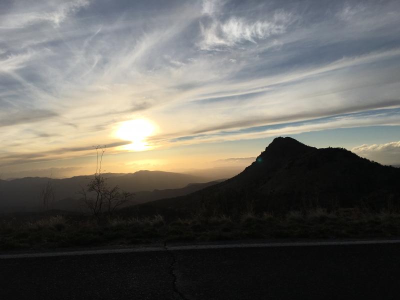
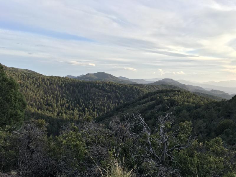
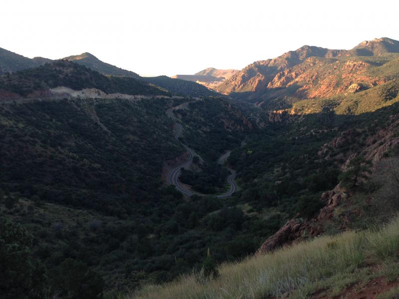
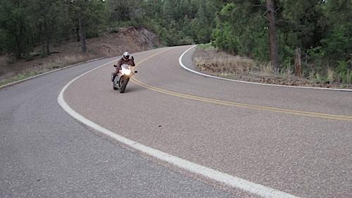
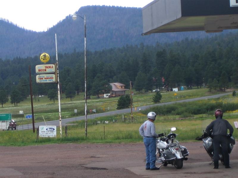
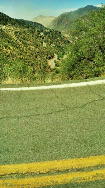
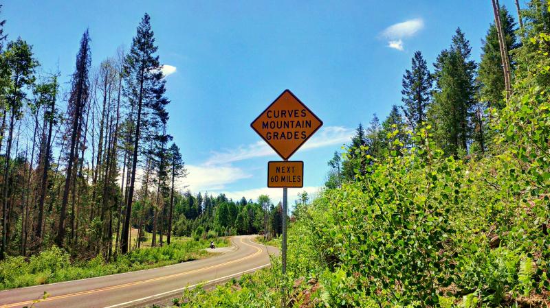
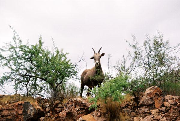
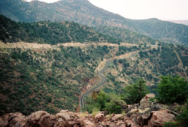
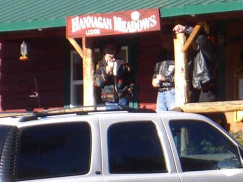
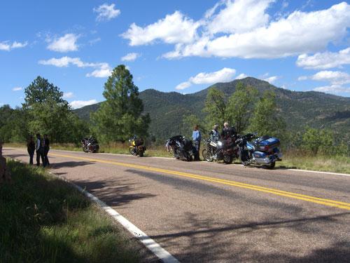
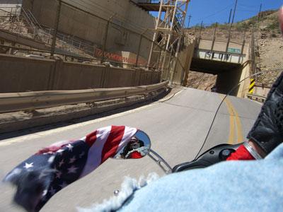
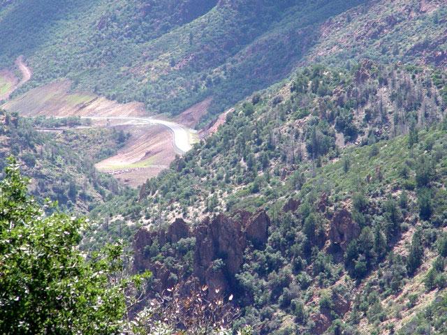
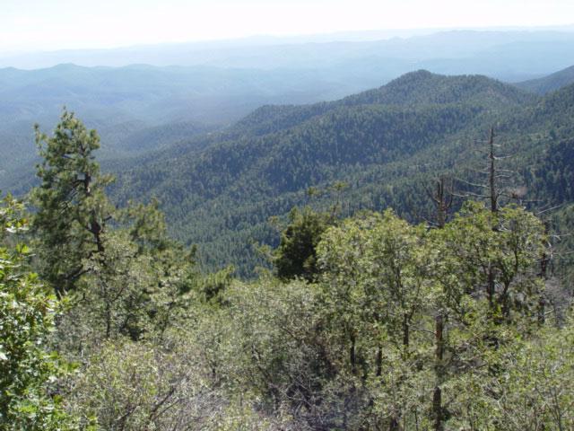
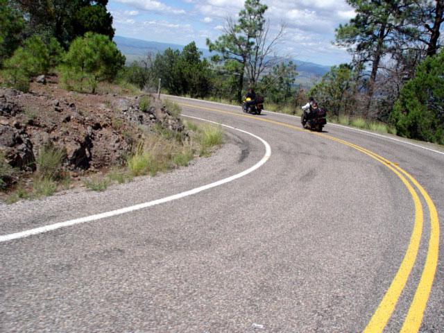
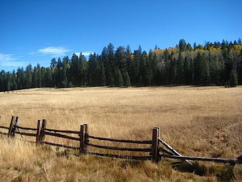
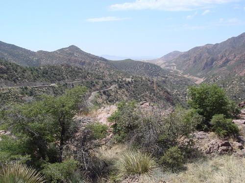
This road brings you to a whole new world in Arizona. Its located in the central eastern part of Arizona and parallels the New Mexico border. To find it on the map, just look for the towns of Eagar (home of the largest stand of pine trees in the US) and Clifton along the Arizona/New Mexico border. The towns are connected by Arizona road 191. You'll start out in a desert environment and end up passing through an Alpine paradise. It is LOADED with twists and turns and even though its in a remote section of Arizona, its well worth the trip. The road starts out in a desert setting near Clifton, AZ ... an old copper mining town. From there heading north and up in elevation, you can stop at a scenic overlook that will give you a look at the world's largest open-pit copper mines. The road will then take you through a canyon as the road hugs some cliffs and continues to dramatically climb (BE CAREFUL). What makes this road so amazing is the big change in scenery you'll see between the start and the finish. The diversity of landscape is due to the change in elevation you'll cover - a 5,000 feet difference from start to finish. You'll start out seeing some nice desert landscapes and then move on into some interesting canyons. You'll see the world's largest open pit copper mine and pass by one of the highest peaks in AZ - Escudilla Mountain (10,800 ft). You'll also see huge pine and aspen forests and some tranquil little meadows as you pass next to the White Mountains and through the Apache-Sitgreaves National Forest. "This was taken at Hannagan Meadow." Update from 1rock1 on 6/13/12: The ride starts at 7500 feet elevation and drops to the 2500 foot level. The drive is full of wildlife, hairpin turns, shear cliffs, dramatic views and finishes with a drive through an open pit copper mine. There is so much metal in the earth the mountains are alive with rust colors making the scenic views some of the best blending White clouds, Blue skies, and the green pines. There are no services between the two cities so fill up in Alpine. Traveling south gives the best views as you are looking out over the Valley. Expect to be traveling for nearly 4 hours without stops as there are nearly 1200 hairpin turns of no more the 15 MPH on this incredible drive.Drive Enjoyment
A true 5-star road for motorcycles. They say there are 427 curves on AZ Road 191 between Clifton and Alpine. The road also has some breathtaking ascents along the way that will keep your engine revving. The most dramatic elevation changes are near the town of Morenci, AZ. In fact, the speed of traffic will slow down to just 10 MPH at certain points!"You all missed the point if you just did half. Try starting in Eager, then heading down 180 then cut across towards Clifton-Morenci on 78 then go back up 191. Round trip is 270 miles and will take about 12 hours to do it. Partly because you of the twisties and partly because you will be stopping at every wide spot to take pictures! Go to www.QuickThrottle.com and check out our Biker Gallery for the Rt 666 ride (this used to be hwy 666)". Update from 1rock1 on 6/13/12: 1200 Hairpin turns, no shoulders and occasional dirt washed across roads from any recent storms that may have passed through.
Tourism Opportunities
There is a lot of camping and hiking trails along the way. You can also take a half mile hike to the Rose Peak watch tower and get a great view of the surrounding landscape. There are many pullouts and look out points that you'll want to have a camera ready for. DON'T MISS the Mogollon Rim. Update from 1rock1 on 6/13/12: Pine is a small town with a view small restaurants and you will pass through Hannigan Meadows that is a great picnic spot. The town of Morenci has a strong Hispanic flavor and has many wonderful restaurants from this ethnicity. It is also Copper mining town and arrangements can be made for a tour of the mine. There is not much along the way except tremendous views of BIG COUNTRY.Motorcycle Road Additional info
Update from 1rock1 on 6/13/12: This is not a ride for a beginner and do not allow the scenery to take your eyes off the road. Make many stops along the way to take pictures and to take in the sights. - View the weather forecast for this area from Yahoo weather .Top Images

Guest
March 11, 2010
0 McR Points
Motorcycle Type : Touring
While attending the 100 year HD Anniversary in Milwaukee in 2003, I ran into these two biker-guys from Germany. They'd come for the birthday bash but as soon as it was over they were headed to Arizona for the sole purpose of riding the Coronado Trail. I immediately put the CT on my "to-do" list, and did it for the first time the following year. Sweepers to the north, undulating pine-lined straights in the middle and technical twisties to the south.
Be advised - while I highly recommend this road for experienced riders, it needs to be said that the southern section is not recommended for beginners especially riding it from north to south - it's very steep and very twisty once it begins dropping off the rim and heading for the desert below. My recommendation, no matter your riding level, is that you try to arrange your route to do Hwy 191 from south to north. Doing so will allow you to stay off your brakes and enjoy the scenery more, and there is plenty of that!
I
Was this road review helpful?
Thumbsup
8 riders found this road review useful

Guest
October 7, 2009
0 McR Points
Motorcycle Type : Cruiser
Actually the road begins in Safford and has nice sweeping curves into Clifton and then actually terminates in Springerville, AZ.. So in reality it is 165 miles and over 450 curves and switchbacks. It offers the experienced technical rider everything needed in a good ride, Haripins, Long Sweepers and directionals. Gas up in Clifton or your next chance is in Alpine. Stop for trhe World famous Pie at the Bear Wallow Cafe in Alpine. Most Importantly BE CAREFEULL, this road will bite back and is not for the faint of heart. So please respect it!. those of us Natives will always call it the "Devil's Highway since the US Route designator changed from 666 to 191 some years ago. it makes Deals Gap ( Tail of the Dragon) and the Pigs Trail in Arkansas, although fun not even in the same ballpark. Some c'mon out to AZ and Dance on the Devil's Highway with us!
Was this road review helpful?
Thumbsup
8 riders found this road review useful

Guest
October 11, 2010
0 McR Points
Motorcycle Type : Sport - Touring
What an amazing drive from Clifton To Eagar, AZ. This road will test your technical driving abilities on each and every curve. The first 25 - 30 miles is straight up with neck wrenching twists and turns and while a person could go faster, DON'T. The rest of 80 or so miles remains twisty with a few sweepers and a short straight of way not far from Hannagan Meadows. The last 20 miles into Eagar is at highway speeds, but watch out for farm equipment.
Reasons not do drive fast. First, rocks fall and there were many corners where you needed to avoid large rocks and gravel in the middle of the travel lane. Secondly, as many others alluded to, traffic can slow to a crawl and you won't know that until you are well into your curve. Additionally, when I went (mid-Oct), the traffic consisted mostly of large pickups with travel trailers that could not avoid drifting over the lines. Next are critters. Squirrels, skunks, deer, elk, and the fifteen cows that decided to take a break in the middle of the road. Watchout for the one with crooked horns (1 up/ 1 down), she was irritable. Didn't see any elk, but I know they are out there. Finally, the scenery is breath taking. Go too fast and you will miss it.
All total, my drive from Clifton to Eagar took nearly 4 hours with plenty of kodak moments and breaks.
Was this road review helpful?
Thumbsup
6 riders found this road review useful
Photo Gallery of Coronado Trail (32 Photos)

0
Thumbsup

Scenic view from the Coronado Trail
0
Thumbsup

At the start of the trail by Morenci mine
0
Thumbsup

0
Thumbsup

0
Thumbsup

Hannagan Meadow Cabin #12 Thiel Cabin
0
Thumbsup

Hannigan Medows Lodge at near top of trail. Great place to stay
0
Thumbsup

0
Thumbsup

0
Thumbsup

0
Thumbsup

Standing right above a sige that says watch out for Mtn Sheep
0
Thumbsup

0
Thumbsup

Looking south about 2/3 of the way from Springerville to Clifton.
0
Thumbsup

0
Thumbsup

0
Thumbsup

0
Thumbsup

sheer cliffs and no guardrails.
0
Thumbsup

0
Thumbsup

0
Thumbsup

Just north of Clifton and the mines.
0
Thumbsup

0
Thumbsup

Date and time: Monday, September 28th, 2015 at 6:42 amLatitude and Longitude: 33 Degree10'19.79"N 109 Degree21'57.92"W
Altitude: 1,830 feet
Google Maps link: https://goo.gl/maps/88CESjRVx6s
Google Maps street view: https://goo.gl/maps/8G9EYZU7Y3J2
Distance to nearest city/town: 14.4 miles (26 minutes) north of Morenci, AZ on US-191 (https://goo.gl/maps/FdesLroyWGQ2)
0
Thumbsup

0
Thumbsup

0
Thumbsup

0
Thumbsup

0
Thumbsup

0
Thumbsup

0
Thumbsup

0
Thumbsup

0
Thumbsup

Video
The ride from East Phoenix up the Devils highway to Springerville back down through Payson. One of the best overnight rides in Arizona.
0
Thumbsup

Video
I have done this route seven times and would do it again tomorrow if I had time. Maybe one of these times I will combine with New Mexico and come back through Hillsboro to Silver City. The is a good route to do over the Holiday because you do not have to deal with the traffic headed back to the Phoenix on 17 or the beeline.
0
Thumbsup

Photo
0

Photo
0

Photo
0

Photo
0

Photo
0

Photo
0

Photo
0

Photo
0

Photo
0

Photo
0

Photo
0

Photo
0

Photo
0

Photo
0

Photo
0

Photo
0

Photo
0

Photo
0

Photo
0

Photo
0

Photo
0

Photo
0

Photo
0

Photo
0

Photo
0

Photo
0

Photo
0

Photo
0

Photo
0

Photo
0

Video
0

Video
0
Interactive Views Along This Route
Start point
Latitude 33.0518451
Longitude -109.2954626
Way point 1
Latitude 33.0727332
Longitude -109.3640102
Way point 2
Latitude 33.1632648
Longitude -109.3680605
Way point 3
Latitude 33.2395649
Longitude -109.381778
Way point 4
Latitude 33.5714036
Longitude -109.341267
Way point 5
Latitude 33.8567895
Longitude -109.157085
Way point 6
Latitude 34.0545576
Longitude -109.1883618
End point
Latitude 34.1097953
Longitude -109.2501699