Overall Route Rating
speedo-meter speedo-arrow
speedo-meter-grey
0 out of 5 Rider Rating 0
0 Review

Motorcycle Route Author

profile Image
By admin (110 McR Points) on May 09, 2019

Rider Reviews

No reviews added for this route. Write a review
Written Directions

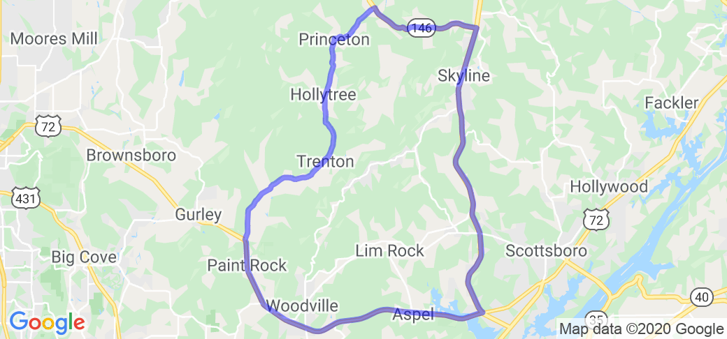
Begin (or end) near Gurley, AL on State Highway 72 (Trail of Tears) where US Highway 72 and AL Route 65 meet (see map). Take 65 east as it winds through the fields and farms of the valley. About 25 miles in 65 will come to a "T" where you need to take a right on to AL Route 146. Drive about 6 miles on AL 146 (this will bring you up Cumberland Mountain) and you will come to the intersection of AL 146 and AL route 79 when you top the mountain. At this intersection/stop-sign, you need to turn right on to AL 79 which will take you down the mountain into Scottsboro (the end point) and ...through a 4 way stop and back to intersect with 72.

Scenery

The valley road winds beside the Paint Rock River (one that is rich in plants and animals only found there). This is not a superslab ride. If you enjoy a cruise through the country...this is for you!

Drive Enjoyment

Basically good asphalt...occasional fault here or there. Some very sharp curves that have bitten more than one biker....be careful!

Tourism Opportunities

Not much to do...just lots of outdoors to see. Gas station when you top the mountain only one on your route in the valley and some just to the west of 65 on 72 in Gurley.

Motorcycle Road Additional info

- View the weather forecast for this area from Yahoo weather .
 

No reviews added for this route. Write a review