Written Directions
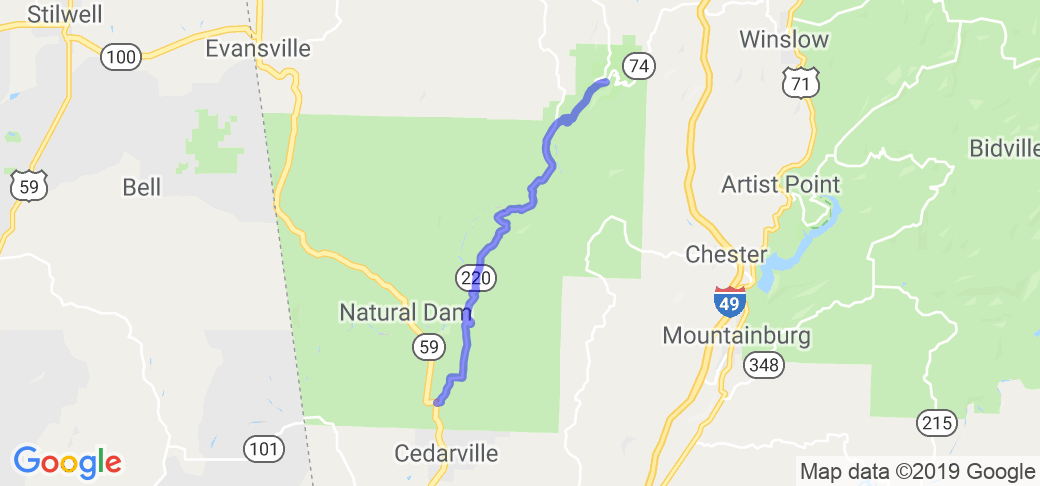
The route starts at the intersection of AR Hwy 170 and AR Hwy 220 in Devil's Den State Park. To get to the park from the south (I-49 northbound), take Exit 45 - Winslow, then follow AR Hwy 74 west to the park. To get to the park from the north (I-49 southbound), take Exit 53 Westfork, then follow AR Hwy 170 south to the park.
Scenery
The route follows Lee Creek for the first 8 miles, climbing up on the ridges in the Boston Mountains then back to the valley floor. The road is cut through a mixed hardwood and pine forest. There are views of the creek flowing through the woods. From the ridges you can view across the valley. In the fall there is enough open spaces to view the fall colors.
Drive Enjoyment
The first 8 miles of AR Hwy 220 was the last unpaved state highway in Arkansas until 2017. In 2017 and 2018 the northern section was graded and paved, so that section is excellent. The section from the Lee Creek bridge to Cedarville is paved, but is much older and rougher. The road is mostly hilly with sweeping curves. There are two sections of tight switchbacks, and a few straightaways. In April 2018 some of the curves on the new section had gravel from the newly graveled shoulder on the roadway.
Tourism Opportunities
The route itself has no amenities, although there are a couple of places where you can stop and wade/swim/fish in Lee Creek. Devil's Den State Park has hiking, camping, cabins, swimming, fishing and mountain biking. Cedarville has a C-Store, grocery, ATM.
Motorcycle Road Additional info
AR Hwy 74 in Devil's Den State Park is steep with tight switchbacks. The park warns against trailers longer than 26' on this road.The caves in Devils Den State Park are closed (since 2009/2010) due to White-Nosed Bat Syndrome.