Overall Route Rating
speedo-meter speedo-arrow
speedo-meter-grey
3.8 out of 5 Rider Rating 3.8
7 Reviews

Motorcycle Route Author

profile Image
By Guest (0 McR Points) on Sep 30, 2007

Rider Reviews

No Image Found
Guest
December 7, 2010
We took this road on our way from Broken Bow up…
Thumbsup
No Image Found
Guest
January 5, 2009
About as scenic a ride as I've found in…
Thumbsup

Written Directions

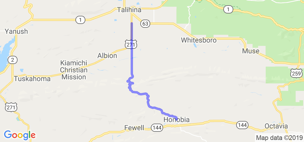
Start in Honobia, OK. Head north out of town on Indian Trail Hwy. Simply stay on this road for about 17 miles till it intersects US Highway 271 just south of Talihina, OK. (See the map).

Scenery

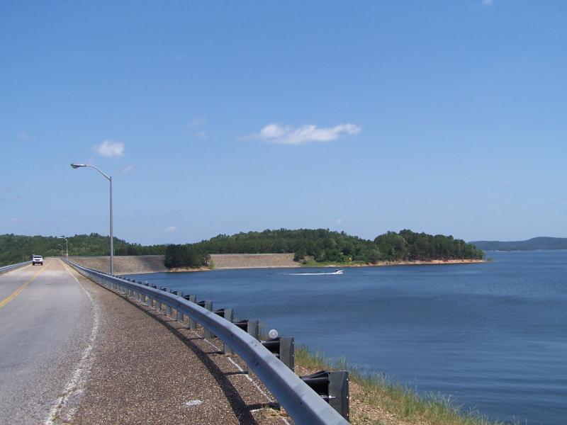
After you start into the mountains the scenery is great. Lots of things to look at. This route travels just south of the beautiful Ouachita National Forest.

Motorcycle Road Quality:4

Road surface is good. This route has a lot of twist, turns, up and downhill runs

Drive Enjoyment

Road surface is good. This route has a lot of twist, turns, up and downhill runs.

Tourism Opportunities

Talihina is five miles north of the start of the road and Honobia is at the other end where it joins Hwy 144. Both towns offer all the amenities you'll need for the trip.

Motorcycle Road Additional info

- View the weather forecast for this area from Yahoo weather .
 

Top Images

Share Your Comments ( 7 )
  Earn McR Points
No Image Found
Guest
March 16, 2010
0 McR Points
Motorcycle Type : Touring
Just got back from this ride! Came straight up from 259 through Honobia. The road to Honobia was great and construction complete, but this road was even better for curves and elevation changes. The two roads together made a great tandem going into Talihina. Highly recommended.
Was this road review helpful?
Thumbsup
1 riders found this road review useful