Motorcycle Route Author

By MCR Contributor (952 McR Points)
on Jul 11, 2011
Rider Reviews
Written Directions
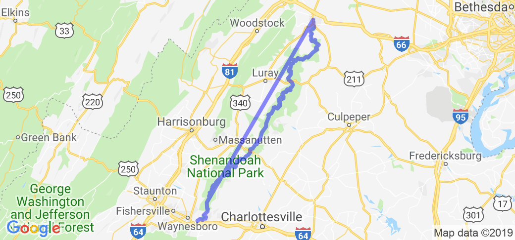
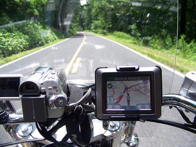
Skyline drive begins in Front Royal, VA which is about 80 miles west of Washington DC. Just hop on Skyline drive and take it south all the way through the Shenandoah National Park ... the end point is basically the town of Waynesboro, VA. From there you can either turn around and do this awesome road again or you could conveniently continue right on to the Blue Ridge Parkway (... another fanScenery
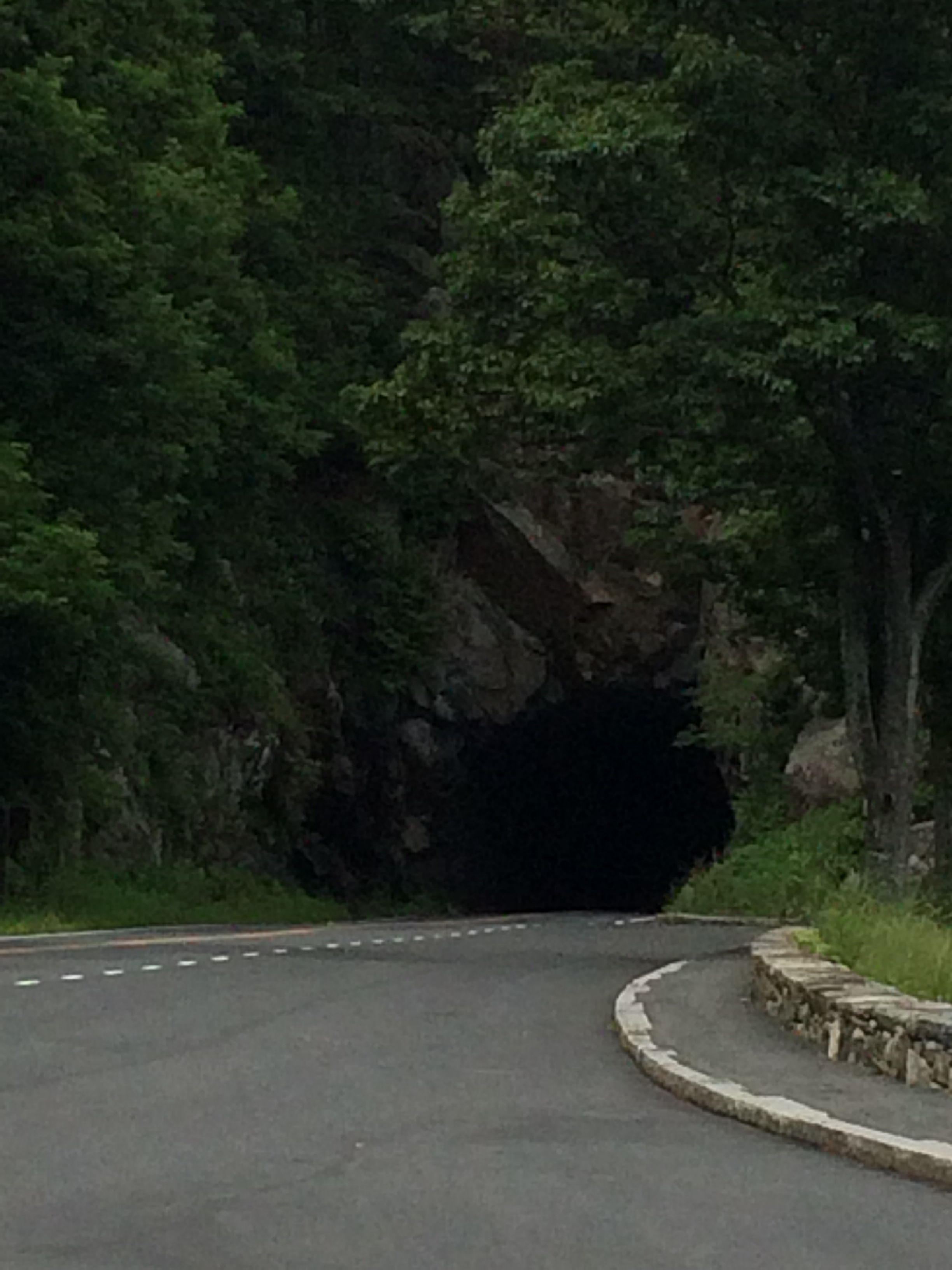
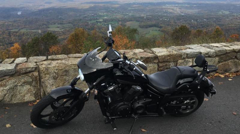
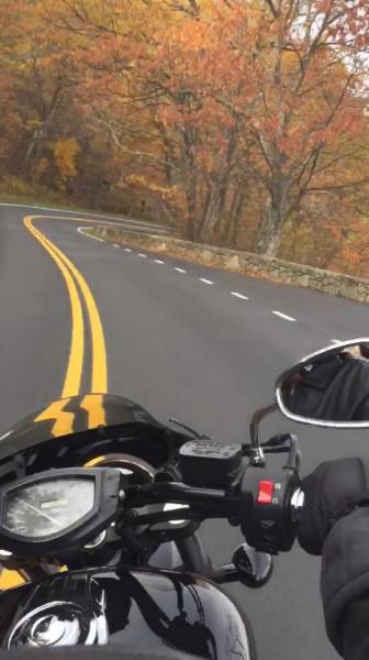
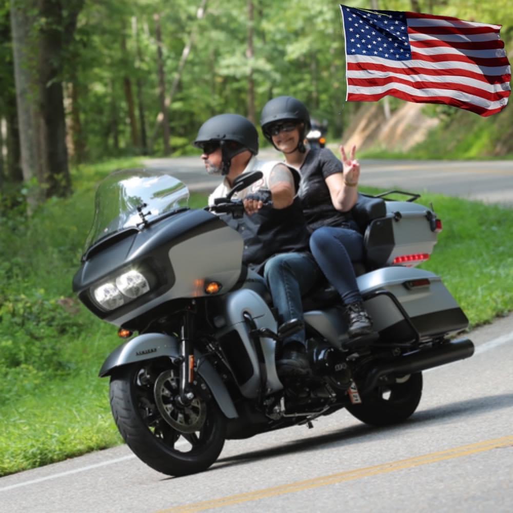
You'll be riding through the beautiful Shenandoah National Park and see great mountain views and wildlife like deer and an occasional black bear ... but you'd better pay attention to the road as its loaded with turns!Drive Enjoyment
It's 105 miles of twisty mountain roads....all smooth, clean road. Speed limit is only 35 mph due to the wilderness and mountains. You may reach 50mph but even at 35 it's very relaxing and enjoyable. Note: it can be damp in the morning from the elevation of the mountains.Tourism Opportunities
Camping....hiking...sightseeing throughout Shenandoah National Park. Plenty of places to pull over, stretch the legs, and take in the beautiful views.Top Images

TheBuffaloSoldier
August 6, 2014
0 McR Points
Motorcycle Type : Touring
In my opinion this ride should be on every motorcyclists bucket list! What a phenominal experience! I rode from TX to NY and took the opportunity to ride The Three Sisters, Natchez Trace Parkway, Cherahola Skyway, Tail of the Dragon, Blue Ridge Parkway and to my delight finished up with Skyline Drive! The variation- curves, hills, straight aways is enought to keep the ride very interesting. On the Blue Ridge and Natchez after a while it felt like the movie Ground Hog Day or 50 First Dates! LOL! But on Skyline Drive there seemed to always be something new around the corner, including a juvenile Black Bear that hung out road side and seemed to pose for pictures. Got a little nervous taking pictures of the little guys because kept wondering if Moma Bear would suddenly make an appearance which would have not been good sitting on a motorcycle. Lot's of places to stop and take pictures at key elevations and Skyline Hotels right on the drive. I made the ride in late July and higher elevations above 4,000ft was quite chilly so bring a jack or fannel shirt even during the summer time when you make this ride! This is a relaxing, varied and truely beautiful scenic ride that I highly reommend to all riders!
Was this road review helpful?
Thumbsup
10 riders found this road review useful

MCR Contributor
July 12, 2011
952 McR Points
Motorcycle Type : Other
We left York Pa, heading for the BRP, and figured it would be a great warm-up. Beautiful scenery, great roads, just amazing. I wanted to stop at every lookout to take in the views. We rode from Ontario not sure what to expect....now we can't wait to do it again. An absolute must.
Was this road review helpful?
Thumbsup
8 riders found this road review useful

Kaz
July 16, 2013
0 McR Points
Motorcycle Type : Cruiser
Beautiful ride. I'm working in DC for 6 months, and I've been here 3 times already. The turns are awesome, the road is well-kept, and the road is angled just perfect throughout the turns.
There are deer and other wildlife throughout the park so watch it.
Also be sure to fill up before you enter the park.
There are deer and other wildlife throughout the park so watch it.
Also be sure to fill up before you enter the park.
Was this road review helpful?
Thumbsup
5 riders found this road review useful
Photo Gallery of Skyline Drive (5 Photos)

Florida Road Trip 2010
0
Thumbsup

GPS shows skyline drive.
0
Thumbsup

105 miles of twisting mountain roads..Got to love it..
0
Thumbsup

Stopping at almost every lookout.....
0
Thumbsup

Video
A little piece of the ride!!!
0
Thumbsup

Photo
0

Photo
0

Photo
0

Photo
0

Video
0
Interactive Views Along This Route
Start point
Latitude 38.9288
Longitude -78.19549
Way point 1
Latitude 38.75763
Longitude -78.25602
Way point 2
Latitude 38.61587
Longitude -78.34342
Way point 3
Latitude 38.17528
Longitude -78.76935
End point
Latitude 38.05305
Longitude -78.83751