Motorcycle Route Author

By Guest (0 McR Points)
on May 31, 2006
Rider Reviews
Written Directions
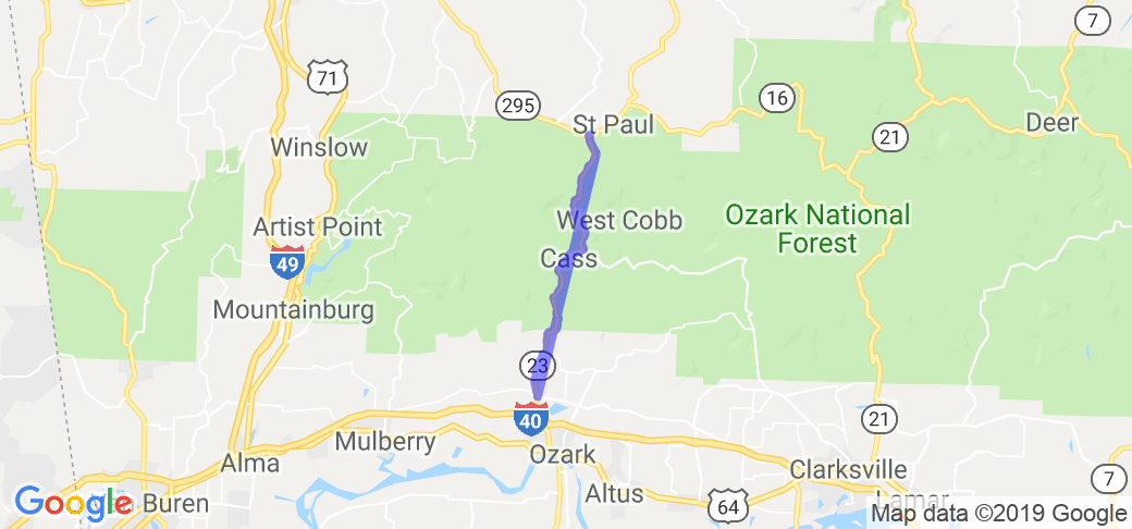
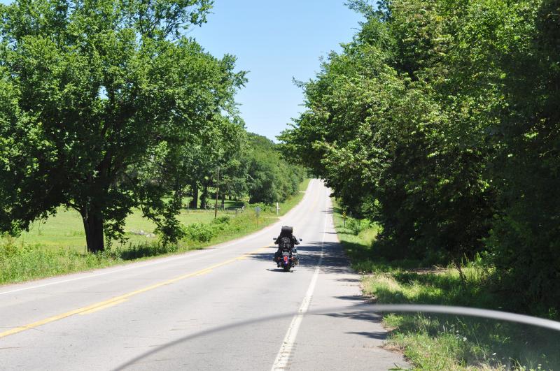
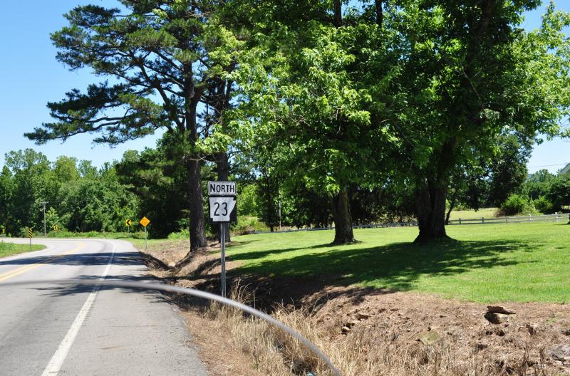
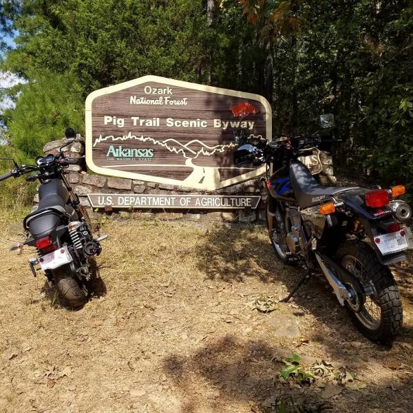
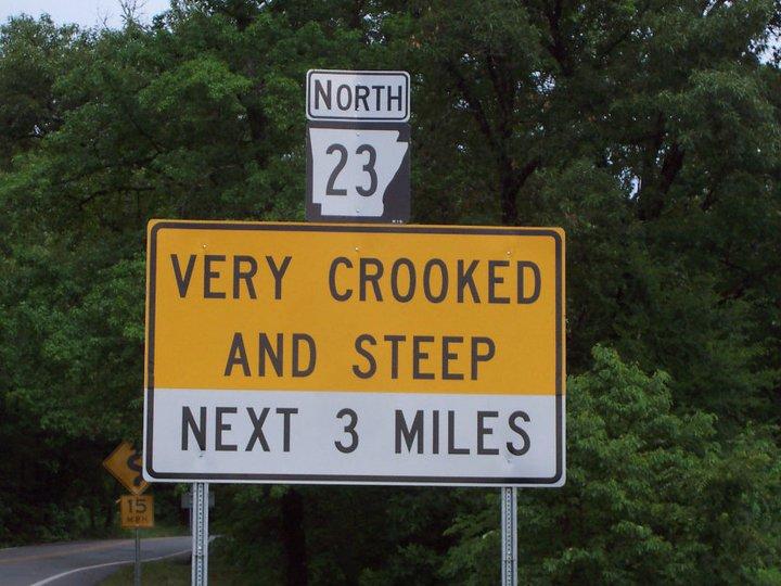
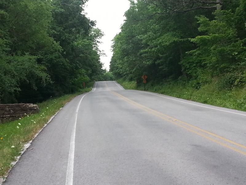
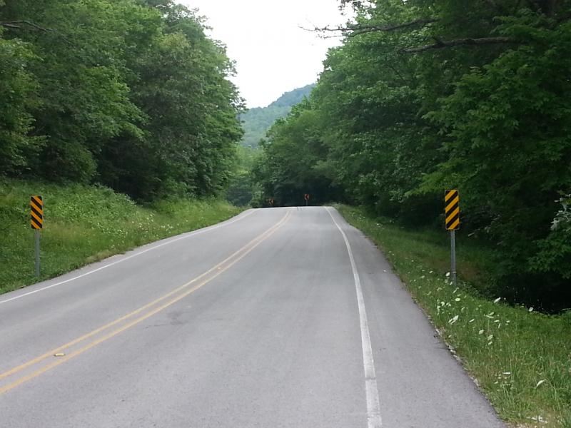
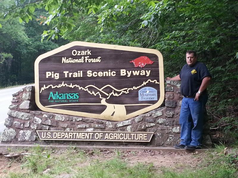
From Interstate 40, near the town of Ozark (between Little Rock and Fort Smith), you will want to take exit 35 north on to Hwy 23 and into (and through) the town of White Oak, AR (Franklin County). Start this motorcycle road where Hwy 23 and Route 352 intersect. From here continue heading north on Hwy 23 and the fun starts when you cross into the Ozark National Forest ... here is where the Pig Trail starts and continues all the way up to where Hwy 23 and Hwy 16 meet (at Brashears Cemetery and just south of the town of St. Paul, AR).Scenery
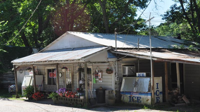
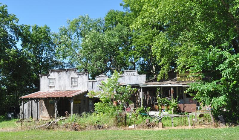
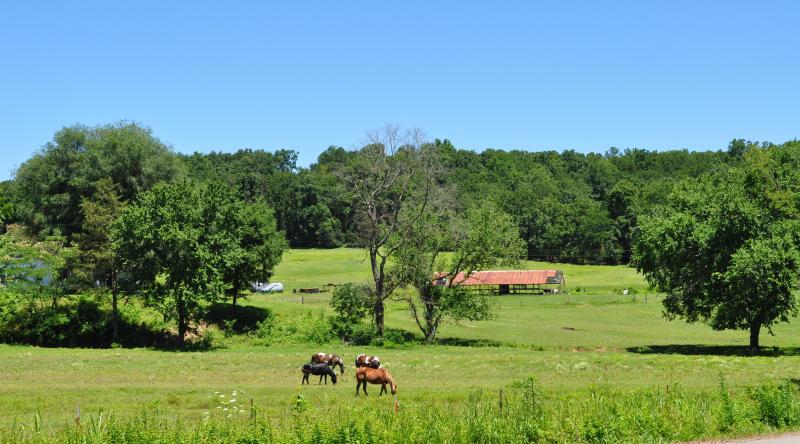
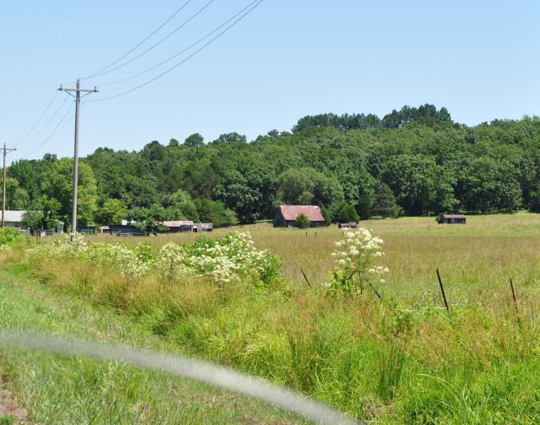
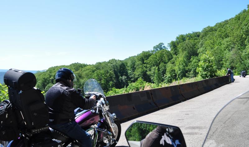
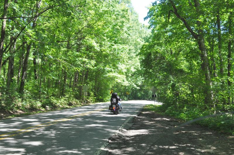
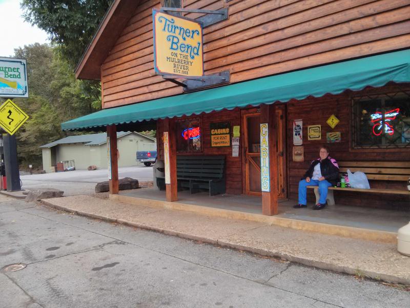
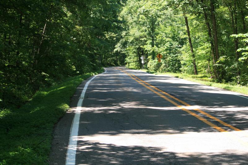
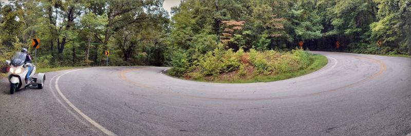
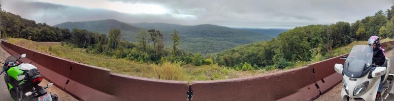
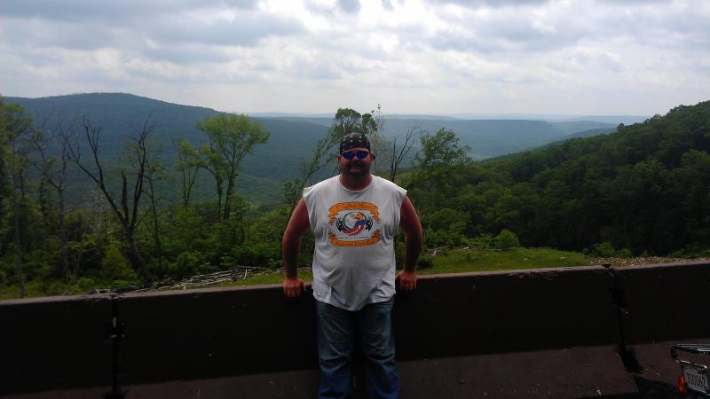
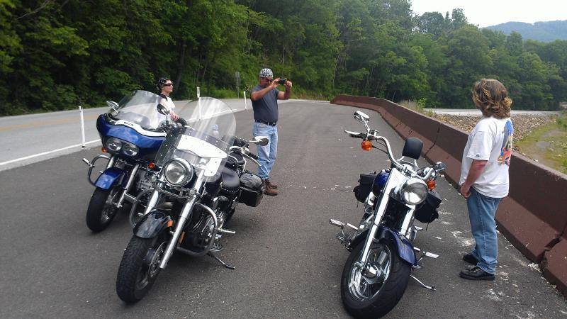
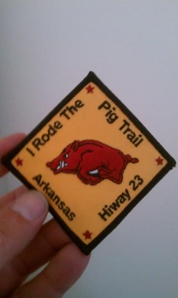
The rugged and forested Boston Mountains region of the Ozark Mountains provides the setting for this route, which often runs through a tunnel of foliage during spring, summer and fall. Spring wildflowers and brilliant autumn foliage make the route especially popular during those seasons. The route crosses the Mulberry River and the 165-mile Ozark Highlands Trail.Additional scenery information submitted by "Bone" (Sep 06) - "Deep wooded terrain, many 15mph hairpins with short straights between them with dropoffs on one side cliffs on the other. The road runs between valleys beside streams to mountain hard curves. This has been called the Arkansas Dragon, and at the one general store midway of the run, you can buy pins and patches of this. The ride can be extended northward another 18 miles to the town of Huntsville where there are complete services, food, gas, lodging. "
Drive Enjoyment
Ark. 23 from the south boundary of the Ozark National Forest to its intersection with Ark. 16 at Brashears. Hair raising hairpin turns, switchbacks, curves, curves, hills, curves and more curves! Not for the faint of heart.Tourism Opportunities
The Pig Trail provides numerous recreational opportunities. Enjoy open fields and pastures, rugged cedar breaks and rocky bluffs or the banks of the Mulberry River. If fishing isn't your favorite activity, brave the rushing waters for a few hours of whitewater rafting or kayaking and afterward spend a night under leafy boughs while the rushing waters from the White River sooth you to sleep. Start off the next day with a hike along the Ozark Highlands Trail, and capture the widespread views beneath you with your camera. There is Turner Bend Store and campground at the "end of the trail" where you can get a patch that says "I survived the Pig Trail" and a campground, along with several lodges and cabin sites along the beginning and end of the ride.Motorcycle Road Additional info
- View the weather forecast for this area from Yahoo weather .Top Images
0 Likes

0 Likes

0 Likes

0 Likes

0 Likes

0 Likes

0 Likes

0 Likes

0 Likes


Guest
April 17, 2011
0 McR Points
Motorcycle Type : Cruiser
My Fiance' and I have been going to Arkansas every year since 2006. Each year we take a 4 day stay and find different routes to ride each day. Last year in 2010 we took a ride from Hot Springs to Eureka Springs taking the Pig Trail. This was by far the best ride we ever had in our entire lives. I'm talking curves, curves and more curves! The trail is very shaded so wear a light jacke,it is was nice and cool in the mountains. All the twist and turns will give you a great workout. My fiance's shoulders were sore on the next day. He said it was the best workout he ever had. If you are ever in Arkansas you must take this route. It's a riders dream!!!!! Don't let not be on a motorcycle stop you from riding the trail; go in whatever you are driving. It's beautiful!!!!
Was this road review helpful?
Thumbsup
18 riders found this road review useful

Brian Fistler
November 23, 2014
67 McR Points
Motorcycle Type : Sport
Rode this 9/12/2014. Was raining for the southern 1/3 of the way from Ozark (both up and back.) Road quality is very good in most sections. Stopped at Turner Bend to pick up some patches & a shirt. If you are camping, there is Aux Arc Park just south of Ozark, which is an Army Corp campground (meaning very inexpensive - like $11 w/hookups.) Half that if you have a senior or disability National Parks pass.
Was this road review helpful?
Thumbsup
9 riders found this road review useful

Guest
August 5, 2009
0 McR Points
Motorcycle Type : Cruiser
Great road! Did this route the first of Nov in 2008 and loved it. The leaves were changing, at peak, and it was beautiful. I like the fact that there is low traffic on such a curvy, scenic, good road. I had done the dragon the month before and really like the Arkansas roads better because they were not crowded and just as thrilling.
Was this road review helpful?
Thumbsup
8 riders found this road review useful
Photo Gallery of Arkansas Pig Trail - Arkansas 23 (28 Photos)

0
Thumbsup

0
Thumbsup

0
Thumbsup

0
Thumbsup

0
Thumbsup

0
Thumbsup

0
Thumbsup

0
Thumbsup

0
Thumbsup

0
Thumbsup

Is THE feeling. Total. Free.
0
Thumbsup

0
Thumbsup

0
Thumbsup

0
Thumbsup

0
Thumbsup

What a Great Ride!
0
Thumbsup

0
Thumbsup

0
Thumbsup

Overlook on the Pig Trail. Rain coming back for another go-round
0
Thumbsup

One of the back-to-back switchbacks on the Pig Trail. You can see the sign for the second one in the upper right of the picture.
0
Thumbsup

Turner Bend store along the Pig Trail. Lots of souvenirs for sale.
0
Thumbsup

The Cat House in Eureka Springs
0
Thumbsup

0
Thumbsup

The canopy of trees gives welcome shade on a hot day.
0
Thumbsup

This place is one of those places that you have to stop at.
0
Thumbsup

This was a nice wide curve located a few miles north of the General Store. Great place to stop for photos of the valley below, mountains in the distance. I'm on the far right, the only one not leaning. Not sure what's up with that...
0
Thumbsup

Video
0
Thumbsup

Video
Riding the Pig Trail
0
Thumbsup

Photo
0

Photo
0

Photo
0

Photo
0

Photo
0

Photo
0

Photo
0

Photo
0

Photo
0

Photo
0

Photo
0

Photo
0

Photo
0

Photo
0

Photo
0

Photo
0

Photo
0

Photo
0

Photo
0

Photo
0

Photo
0

Photo
0

Photo
0

Photo
0

Photo
0

Photo
0

Video
0

Video
0
Interactive Views Along This Route
Start point
Latitude 35.5446883
Longitude -93.8595406
Way point 1
Latitude 35.5656829
Longitude -93.8613276
Way point 2
Latitude 35.6464149
Longitude -93.8395329
Way point 3
Latitude 35.7026064
Longitude -93.8041446
Way point 4
Latitude 35.7455936
Longitude -93.8127823
Way point 5
Latitude 35.7807941
Longitude -93.7951058
End point
Latitude 35.8124862
Longitude -93.7941805