Motorcycle Roads

MotorcycleRoads.com is the place to find the best motorcycle roads, routes, rides, and trips. There are millions of miles of roads in America, but not all roads are created equal.  There are roads and there are motorcycle roads - riders know the difference. Planning spectacular motorcycle trips near year starts here by finding the best motorcycle roads and motorcycle routes because great roads lead to great rides!

 
Around the edge of Colorado (segment 3 of 8) - Alamosa CO to Mesa Verde CO |  United States
1863 In United States of 1977 Routes 196 Miles. Roughly 5 hours of saddle time Miles 0Followers
Shares
Scenery
Ride Enjoyment
Tourism Opportunities
Day 3 takes you back into the forests and through a major mountain pass near Beaver Creek. Beware of wildlife and open cattle ranges. That's right: cattle grazing with no fences to keep them off the…
speedo-meter speedo-arrow
speedo-meter-grey
Route has not been rated yet 0
Around the edge of Colorado (segment 2 of 8) - Sublette KS to Alamosa CO |  Colorado
72 In Colorado of 81 Routes 331 (about 6 hours of saddle time Miles 0Followers
Shares
Scenery
Ride Enjoyment
Tourism Opportunities
This segment transitions from straight and flat, to brush and gullys with some rolling hills and long sweeps. Once you get to Walsenburg, you hit the first mountain pass. Rising terrrain and good…
speedo-meter speedo-arrow
speedo-meter-grey
Route has not been rated yet 0
Around the edge of Colorado (segment 1 of 8) - Ottawa KS to Sublette KS |  United States
1820 In United States of 1977 Routes 336 Miles 0Followers
Shares
Scenery
Ride Enjoyment
Tourism Opportunities
This is a long flat part of the trip just to get to somewhere interesting. I stayed on the 2 lane as much as possible.
speedo-meter speedo-arrow
speedo-meter-grey
Route has not been rated yet 0
The Kentucky Rattlesnake 192 |  United States
1799 In United States of 1977 Routes 22 Miles 0Followers
Shares
Scenery
Ride Enjoyment
Tourism Opportunities
In addition to the twists and turns, visitors will observe a couple of waterways through the Daniel Boone National Forest: Kentucky River at Bee Rock as well as Buck Creek. Visitors can expect to…
speedo-meter speedo-arrow
speedo-meter-grey
Route has not been rated yet 0
Decatur-Forestburg Loop |  United States
1777 In United States of 1977 Routes 58 Miles 0Followers
Shares
Scenery
Ride Enjoyment
Tourism Opportunities
This route essentially circles the LBJ Grasslands. There are hills and valleys--but it's north Texas, not Colorado. Mostly farm and cattle grazing land. For being less than an hour away from the DFW…
speedo-meter speedo-arrow
speedo-meter-grey
Route has not been rated yet 0
Connection between 55 & Bogus Basin |  United States
1751 In United States of 1977 Routes 9 Miles 0Followers
Shares
Scenery
Ride Enjoyment
Tourism Opportunities
There's honestly nothing to see here, there are some new home developments and rolling hills. There are a few supersized homes, a few farms and a person who wants you to slow down so you don't take…
speedo-meter speedo-arrow
speedo-meter-grey
Route has not been rated yet 0
The Stanton Ball Buster |  United States
1720 In United States of 1977 Routes 47 Miles 0Followers
Shares
Scenery
Ride Enjoyment
Tourism Opportunities
Much of this area was obscured by trees and I was very focused on the road, however, I did notice some arches and very nice views pop out when there was a break in the trees. It is rural Kentucky…
speedo-meter speedo-arrow
speedo-meter-grey
Route has not been rated yet 0
Highway YY - Franklin County |  United States
1701 In United States of 1977 Routes 14 Miles 0Followers
Shares
Scenery
Ride Enjoyment
Tourism Opportunities
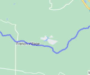
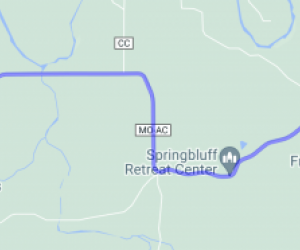
The route travels through the woods, hills, and farmlands of Franklin County, MO, which is typical mid-Missouri countryside.
speedo-meter speedo-arrow
speedo-meter-grey
Route has not been rated yet 0
Seven Sisters Falls to West Hawk Lake via 307 & 44 (Manitoba, Canada) |  Routes Around the World
115 In Routes Around the World of 162 Routes 49 miles or 78 Miles 0Followers
Shares
Scenery
Ride Enjoyment
Tourism Opportunities
This is the western part of the Canadian Shield and is mostly in Whiteshell Provincial Park. I love the ruggedness of this area with plenty of lakes and river crossings. Whiteshell Provincial Park…
speedo-meter speedo-arrow
speedo-meter-grey
Route has not been rated yet 0
Fundy Trail Parkway (New Brunswick, Canada) |  Routes Around the World
109 In Routes Around the World of 162 Routes 11 miles or 18 Miles 0Followers
Shares
Scenery
Ride Enjoyment
Tourism Opportunities
The Fundy Trail Parkway is a 2,559-hectare park featuring a 30-km (19-mi.) drive hugging the Bay of Fundy coast with stunning views in every direction. It's a fascinating ecosystem with access to…
speedo-meter speedo-arrow
speedo-meter-grey
Route has not been rated yet 0
Scappoose - Vernonia Highway |  United States
1677 In United States of 1977 Routes 20 Miles 0Followers
Shares
Scenery
Ride Enjoyment
Tourism Opportunities
Rural Oregon hills, sparsely populated. The older forest sections in the middle are pleasant and shady. Not a lot of extended views on this stretch due to the hills and trees. Scappoose itself is…
speedo-meter speedo-arrow
speedo-meter-grey
Route has not been rated yet 0
Miami River Road |  United States
1653 In United States of 1977 Routes 13 Miles 0Followers
Shares
Scenery
Ride Enjoyment
Tourism Opportunities
Nothing too amazing along the route for coastal Oregon, aside from Tillamook bay at the south end, but a lovely river valley, and some forests and hills. A lot of pleasant shade for a hot day.
speedo-meter speedo-arrow
speedo-meter-grey
Route has not been rated yet 0