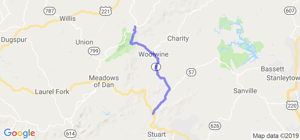
Written Directions
Starting from Bull Mountain Fork at the intersection of VA Hwy 8 and US Hwy 58 6 miles north of Stuart VA, stay to the right of the fork and follow Hwy 8 17 miles to Tuggles Gap where Hwy 8 meets with the Blue Ridge Parkway. If you want more twisties, you can get on the BRP and head west for 12.5 miles to Meadows of Dan VA, then head south on Hwy 58 back to Stuart. (Hwy 58 is already listed as part of the "Greensboro, NC - Blue Ridge Pkwy - Winston-Salem" route.
Both Hwy 8 and 58 are great twisty roads, but I feel Hwy 8 has a bit steeper grade and somewhat tighter curves, so it's more fun, for me, going up Hwy 8, then back down the mountain via Hwy 58.
Scenery
This road will take you along fields, streams and woods for the first 12 or so miles with scenic sweepers then you will suddenly enter more dense forest and start climbing an 8 or 9% grade with great twisties and a 55 MPH speed limit, allowing you to get on the throttle and climb the mountain.
Drive Enjoyment
Hwy 8 is in great condition (as is Hwy 58, should you decide to come back via that route).The road is usually free of gravel and other debris, however there is 1 right-hand curve that has a moderate pothole in the middle of the north bound lane. (shouldn't be a problem if you are following the proper line, and if you are not going so fast that you are taking the optimal line through the curve, then pothole isn't bad enough to worry about.)
This road does carry local traffic and some blind curves, so be aware and ride accordingly.
Tourism Opportunities
Gas is available in Stuart, as well as at a road-side produce area 2 miles south of the start point on Hwy 8. At the north end in Tuggles Gap there is a restaurant and motel, but I've never eaten there, but no gas. If you follow the BRP west for 10 miles, there is a restaurant at Mabry Mill, and 2 miles farther west from Mabry Mill is Meadows of Dan with gasoline. (Mabry Mill is the single most photographed location along the entire 469 miles of the Blue Ridge Parkway.)


 Write a review


 | United States")


 | United States")


 | West Virginia")

! | United States")


