Written Directions
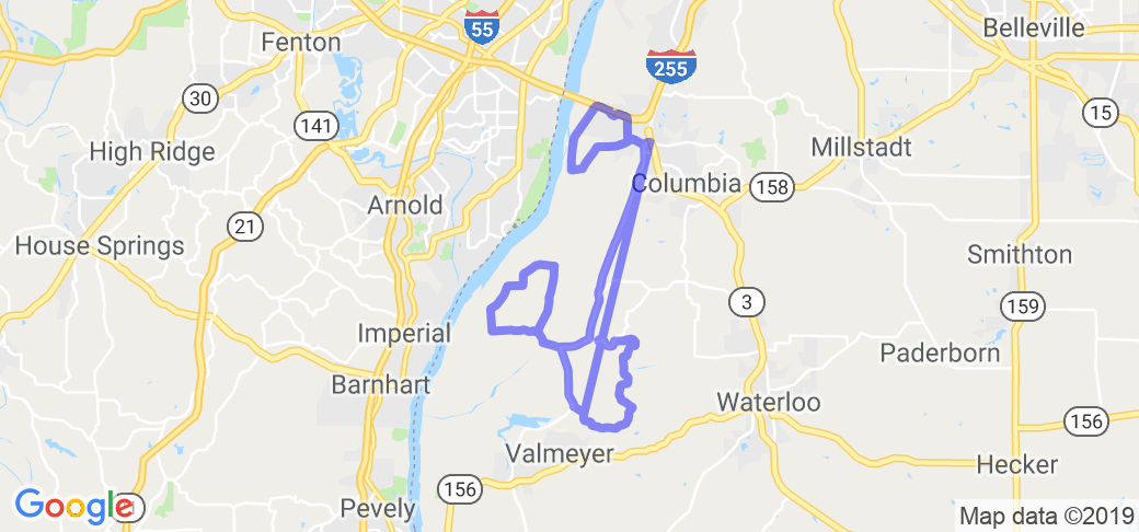
Get yourself to Columbia, IL and find route 3. About 1/2 mile south of where route 3 meets I-255 is an exit for county road 6 (AKA Bluff road). Start the route by going west on CR 6/Bluff road off of route 3. Quickly you'll come upon the intersection of county road DD ... take a right on to DD and follow that for about 2 miles and take the first possible right (name?). Quickly you'll come to a T intersection with Levee road and want to take a right there and follow that all the way around, past the golf course and it will T into county road DD where you started (you just did the first loop!). Now take a left on DD and soon you'll want to take a right on Bluff road. Now stay on Bluff road heading south for 7 miles and then take a left on to HH road (now you're starting your second loop). Drive up the hill (THIS SECTION IS BEAUTIFUL IN THE FALL!!!) and take your first right on to D road. About three miles up the road you want to take a right on to Trout road and it will T back into Bluff road where you now want to take a right. Follow Bluff road back past HH (you just completed the second loop!) and then take a left on to B road. Stay on B road as it heads west, then south and then T's into Merrimac road where you want to take a left and stay on this till it T's with Levee road where you want to take a right and then a left on to Fountain road which will quickly merge into Bluff road heading north again. You've completed your third and final loop!!!
Sound confusing? Well it's really not that bad and but like I said before, just get down to this area of the Mississippi River valley and check out the levee roads and head up into and out of the bluffs and you'll have a ball. Happy driving!!!
Scenery
On this route you'll start out by cruising high above the surrounding areas as you drive a series of Army Corps of Engineers flood levees. Along the route are quaint little farms and patches of woods. Later the route takes you into and up on some huge cliffs that parallel the flood plane. These cliffs are actually limestone bluffs that rise a couple hundred feet above the flood plain and parallel the river for much of its path through Illinois. This part of the route is extremely beautiful in the fall due to the colors displayed by the surrounding woods. The route then descends and leaves the bluffs and takes you northward where the road rides next to base of the huge bluffs for the remainder of the route.
Drive Enjoyment
The roads found on this route are very unique because of the levees they are built on. These levees rise approximately 30 feet above the surrounding land and offer a nice view on either side of the road. However, BE CAREFUL of loose gravel that collects at the intersection of various roads along the route. Also, when you check out the map for this route, keep in mind that some roads aren't marked very well ... if you miss a turn don't worry because plenty of this area is worth exploring that isn't on the specific route I've submitted.
Tourism Opportunities
You won't take this route for the "Roadside Amenities" ... its more for the scenery and unique roads. There are a few places to pull over along this route yet no government run parks. There is a small tavern along the way that pops up out of nowhere, other than that you will have to drive into the town of Columbia after driving the route to find any gas or food.
Motorcycle Road Additional info
- View the weather forecast for this area from Yahoo weather .


 Write a review


 | United States")


