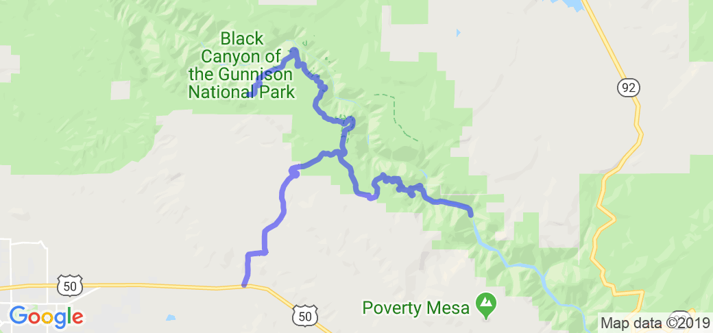
Written Directions
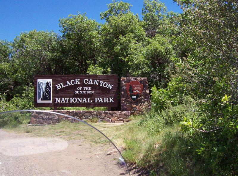
From Montrose, CO, head east on Hwy. 50 about 8 miles to Hwy. 347. Signs for the park will direct you north about 5 miles to the park entrance station. An immediate right turn will take you down about 5 miles to the Gunnison River. At the top again, you can proceed along the south ridge of the canyon with numerous view points and the visitor center.
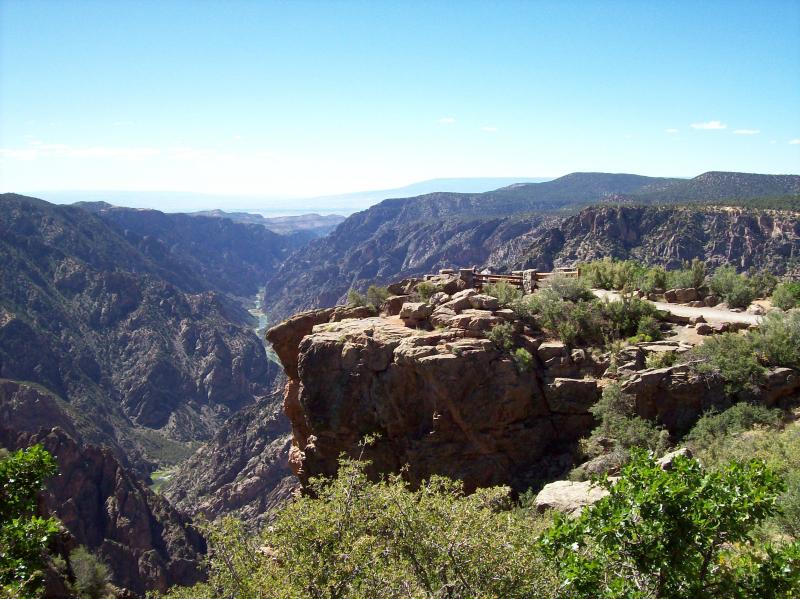
Scenery
It's hard to judge what's beautiful and what's ordinary. This short ride is a journey to view some of the oldest rock in the USA and a chance to see the results of geological action over the last billion and a half years. To me, that's not ordinary.
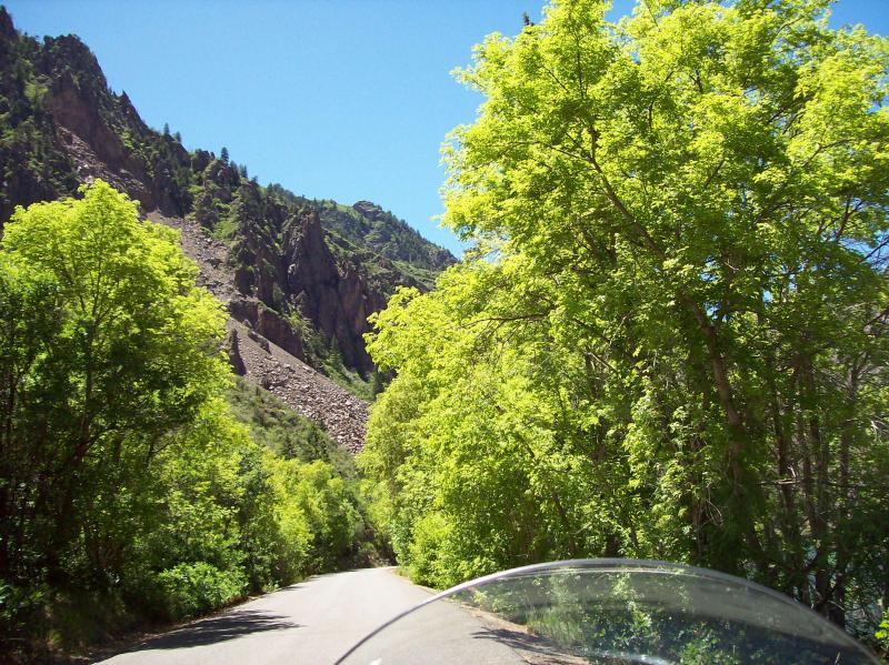
You start your trip from ranch land in the lower valley out of Montrose where you will pass through some pinion/juniper forest. Most of these trees are less than 20' high, which is normal for semi-arid land. As you approach the park at about 8300', you come into more Gamble oak and mountain mahogany bushes up to about 10'. This is also the vegetation along the rim. Dropping down by the Gunnison River, the vegetation changes to taller conifer trees and many healthy broadleaf deciduous trees that are benefited by the cooler, moisture air and water from the river.
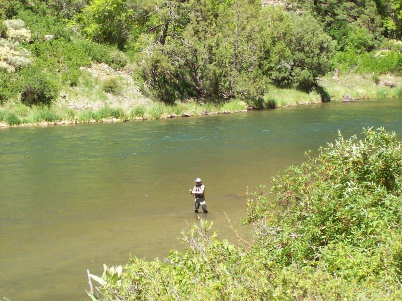
There is a picnic area and restrooms down at the bottom, plus this area is much cooler during the summer.
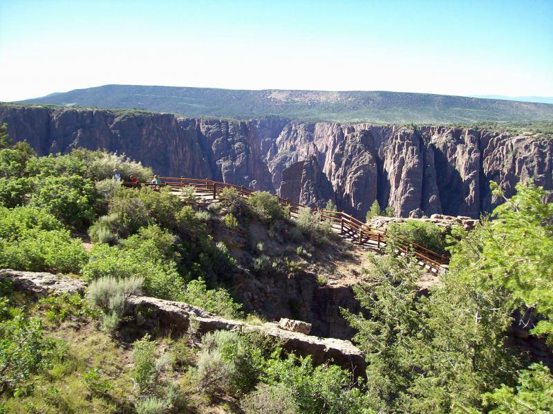
The elevation here is 2772' below the highest point of the canyon walls. Back at the top of the canyon wall, you can travel another 10 miles, or so, on around the ridge overlooking the canyon you were just down in.
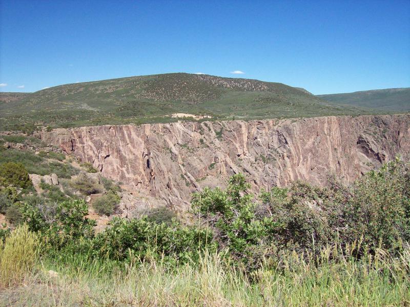
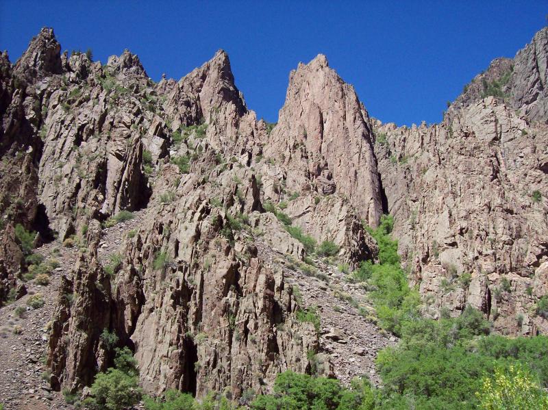
The river took about 2 million years to cut through the rock as the land kept rising. There is the interesting history of man realizing there was no easy way across this extremely deep canyon, nor an easy way to travel down it or use the water for cultivation either. But the rock is the story.
In the past, the river cut through softer volcanic rock from nearby eruptions that flowed over the area. Then it cut through harder crystalline rock, especially forceful before the upstream dams that are now present. Along the walls are tremendous displays of intrusions, which were formed by hot volcanic magma being forced up through cracks in rock above it. Now they look like colored lines printed on the opposing sheer rock walls.
Of course, a stop at the visitor center is a must to see the displays and the short movie on the history of the canyon and descriptions of the animals that are often here. For those interested, there are more detailed descriptions of the types of rock and history of its formation. There are also many picture boards along the rim with informative details.
Drive Enjoyment
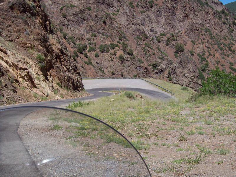
The road to the bottom of the canyon is about 5 miles long and drops about 1700'. The grade is 16% and has lots of slow, sharp, steep turns. The pavement has many road snakes and is about a 3 star. The ridge road, however, is a solid 5 stars and has longer sweeping turns and lots of pullouts.
Tourism Opportunities
Other than restrooms and some picnic tables, there really isn't anything. Montrose (about 20 miles away) has all services. However, the stops at the visitor center and the view points along the way are great so in the end the Roadside Amenities rating is a 3 out of 5.


 - Canyon loop south of Laramie | Colorado")
 - Mesa Verde CO to Loma CO | Colorado")
 - Sublette KS to Alamosa CO | Colorado")


 Write a review


 - Alamosa CO to Mesa Verde CO | United States")


 | United States")


 | United States")


