Written Directions
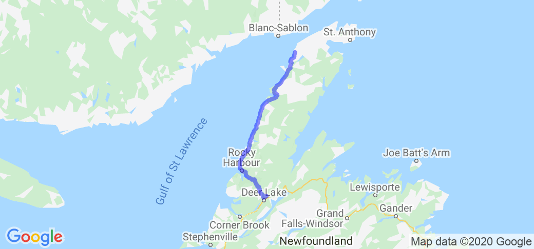
This route starts at St. Barbe at the ferry dock where the ferry from Blanc Sablon comes in. Take the local ferry road about a mile to NL Rt. 430. Turn right and head south about 125 miles towards Gros Morne park. After the park the route swings southeast to its junction with Rt.1
Scenery
You follow the shore of the Gulf of St. Lawrence the majority of this route with water on the right and hiils to the left. There is abundant wildlife, especially Moose, along this route. there are many little coves and bays along the route. The further south you go to Gros Morne, the tablelands get taller and you pass some beautiful lakes towards Rt. 1.
Drive Enjoyment
The pavement is excellent on this route. The route has long straights with sweepers mixed in. Being along the shore the route id generally flat. Near and after Gros Morne the rout does pass through some hills on the way to Rt. 1
Tourism Opportunities
There are a lot of small towns along this route with lodging, food and gas. Obviously Gros Morne National Park is the main attraction. You can take a boat ride on the Western Brook Pond to see towering cliffs. There are hikes in the park. Port Au Choix has a historical sight with artifacts from the First Peoples. Arches Provincial Park is a nice stop for pictures. The East Arm is another area with pulloffs for nice photos.
Motorcycle Road Additional info
At the junction of the St. Barbe Ferry Road and NL Rt. 430 you can turn left and head north to the L"Anse aux Meadows National Historic Site with a reconstructed Viking settlement and exhibits.


 | Routes Around the World")
 | Routes Around the World")
 | Routes Around the World")
 | Routes Around the World")
 | Routes Around the World")
 | Routes Around the World")
 | Routes Around the World")
 | Routes Around the World")
 | Routes Around the World")
 | Routes Around the World")
 | Rocky Mountain")


 Write a review


 | Routes Around the World")

 | Routes Around the World")
 | Routes Around the World")
 | Routes Around the World")
 | Routes Around the World")
 | Routes Around the World")
 | Routes Around the World")
 | Routes Around the World")
 | Routes Around the World")
 | Routes Around the World")
 | Routes Around the World")
 | Routes Around the World")
 | Routes Around the World")
 | Routes Around the World")
 | Routes Around the World")
 | Routes Around the World")
 | Routes Around the World")
 | Routes Around the World")


