Motorcycle Route Author

By Guest (0 McR Points)
on Mar 01, 2008
Rider Reviews
Written Directions
Starts in Chico and simply head northeast on Highway 32 to Chester & Lake Almanor. You'll be on highway 32 for almost all of the route except for a short section at the end where you turn right on to highway 36 and follow to Chester.Scenery
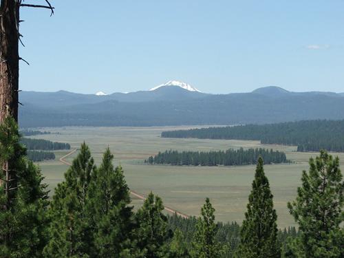
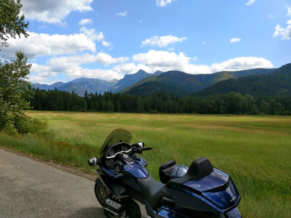
Lots of elevation changes different rock formations, steep canyons, Deer creek with 5 bridges crossings, pastures, Lake Almanor, and pine trees. You'll be passing through the beautiful Lassen National Forest.Drive Enjoyment
A nice twisty mountain road that is maintained year round however has some pot holes and you'll need to watch out for rocks on road. Check weather as there is lots of snow in winter and black ice in some spots. Even if road conditions are pristine, this is not a tranquil ride with all the turns and climbs ... you must be up for this ride.Tourism Opportunities
Couple of stops along the way but plenty of places to eat or refuel at the route's end point in Chester/Lake Almanor.Motorcycle Road Additional info
- View the weather forecast for this area from Yahoo weather .Top Images

Guest
July 29, 2009
0 McR Points
Motorcycle Type : Touring
This is a nice scenic road. To make it a really nice day's ride, continue on Hwy 89 From Chester to Greenville where you can stop for a walk around the town or have lunch at one of the cafes. From there continue on 89 until it meets up with Hwy 70 towards Oroville and Paradise --you are following the Feather River Canyon which is very scenic. Watch for bald eagles along the way. Paradise has a number of good restaurants on Skyway --La Posada, Cozy Diner, Kalico Kitchen, Moon Gate --all with good sized portions for reasonable prices. Another scenic option is to take hwy 70 east towards Quincy then to 395 which will take you into Reno.
Was this road review helpful?
Thumbsup
2 riders found this road review useful

Guest
August 10, 2008
0 McR Points
Motorcycle Type : Sport - Touring
North West side of lake has camping, food store, resturaunt and laundromat. South west is pure camping. Good jump off place dor Lassen.
Was this road review helpful?
Thumbsup
0 riders found this road review useful
Photo Gallery of Highway 32 - from Chico to Lake Almanor (2 Photos)

0
Thumbsup

0
Thumbsup

Photo
0

Photo
0
Interactive Views Along This Route
Start point
Latitude 39.73597
Longitude -121.81984
Way point 1
Latitude 40.27595
Longitude -121.41656
End point
Latitude 40.29816
Longitude -121.23688